Back Dálnice A4 (Polsko) Czech A4 (Polen) Danish Autostrada A4 (Polen) German Pola aŭtovojo A4 EO Autostrada A4 (Polonia) Spanish Autoroute A4 (Pologne) French Autocesta A4 (Poljska) Croatian A4-es autópálya (Lengyelország) Hungarian Autostrada A4 (Polonia) Italian Autostrada A4 (Polonia) LMO
| Autostrada A4 | ||||
|---|---|---|---|---|
 | ||||
| Route information | ||||
| Part of | ||||
| Length | 669 km (416 mi) | |||
| Major junctions | ||||
| From | ||||
| ||||
| To | Polish-Ukrainian border at Korczowa-Krakovets - | |||
| Location | ||||
| Country | Poland | |||
| Regions | Lower Silesian Voivodeship Opole Voivodeship Silesian Voivodeship Lesser Poland Voivodeship Podkarpackie Voivodeship | |||
| Major cities | Wrocław, Gliwice, Katowice, Kraków, Rzeszów | |||
| Highway system | ||||
| ||||


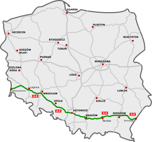
The A4 autostrada in Poland is a 669 km (416 mi) long east–west motorway that runs through southern Poland, along the northern side the Sudetes and Carpathian Mountains, from the Polish-German border at Zgorzelec-Görlitz (connecting to the A4 autobahn), through Wrocław, Opole, Gliwice, Katowice, Kraków, Tarnów and Rzeszów, to the Polish-Ukrainian border at Korczowa-Krakovets (connecting to the M10). It is a part of European route E40.
The motorway between Wrocław and Kraków (270 km (170 mi)) was constructed between 1976 and 2005. The part from Mysłowice to Kraków is tolled (see Tolls).
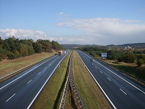
The section from the German border to Wrocław (151 km (94 mi), not tolled) was constructed between 2002 and 2009, in large part as repavement of the old concrete motorway constructed from 1933 to 1937 (then the territory of Nazi Germany). The repaved parts are substandard due to lack of emergency lanes and the speed limit is decreased to 110 km/h.
The motorway from Kraków to the Ukrainian border (251 km (156 mi), not tolled) was constructed between 2010 and 2016, making A4 the first Polish complete border-to-border highway connection.
