Back آلاتور (هیندوستان) AZB Alathur Spanish آلاتهور FA आलतूर HI ആലത്തൂർ Malayalam Alathur Malay ஆலத்தூர், பாலக்காடு மாவட்டம் Tamil آلاتور UR Alathur, Gundlupet VI
This article needs additional citations for verification. (November 2016) |
Alathur | |
|---|---|
 Alathur | |
| Coordinates: 10°38′53″N 76°32′18″E / 10.64806°N 76.53833°E | |
| Country | |
| State | Kerala |
| District | Palakkad |
| Government | |
| • Type | Panchayati Raj (India) |
| • Body | Alathur Panchayat |
| Area | |
• Total | 19.62 km2 (7.58 sq mi) |
| Population (2011)[1] | |
• Total | 26,720 |
| • Density | 1,361.88/km2 (3,527.3/sq mi) |
| Languages | |
| • Official | Malayalam, English |
| Time zone | UTC+5:30 (IST) |
| PIN | 678541 |
| Telephone code | 04922 |
| Vehicle registration | KL-49 |
| Nearest city | Palakkad |
| Parliament constituency | Alathur |
| Assembly constituency | Alathur |
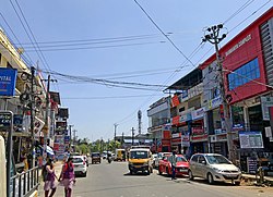
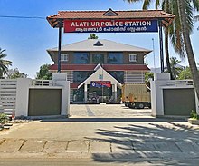
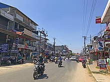
Alathur is a town, taluk and gram panchayat in Palakkad District, Kerala, India.[2] It is the administrative headquarters of the Alathur Taluk and is situated about 24 km from the district headquarters Palakkad through National Highway 544.Gayathripuzha River , one of the tributary of Bharathapuzha, flows through Alathur.[3] Alathur is one among the 20 Parliamentary Constituencies in Kerala.[4] A Mini Civil Station is also located here which provides government related services.[5]


- ^ "Kerala (India): Districts, Cities and Towns - Population Statistics, Charts and Map".
- ^ "Reports of National Panchayat Directory". Ministry of Panchayati Raj. Archived from the original on 30 December 2013. Retrieved 30 December 2013.
- ^ "Gayathripuzha River, India Tourist Information". www.touristlink.com. Retrieved 13 August 2022.
- ^ "Parliamentary constituencies in Kerala and Assembly segmants". keralaassembly.org. Retrieved 13 August 2022.
- ^ Keralam, Digital. "Mini Civil Station Alathur, Palakkad". Digital Keralam. Retrieved 5 September 2022.

