Back البارة (سوريا) Arabic الباره (سوريا) ARZ Al-Bara Catalan Al-Bara German Αλ Μπαρά Greek Al-Bara Spanish Al-Bara EU باره، سوریه FA Al-Bara French Պարա (Սուրիա) HYW
بارة | |
 Ruins of Bara | |
| Location | Idlib Governorate, Syria |
|---|---|
| Coordinates | 35°40′59″N 36°31′59″E / 35.683°N 36.533°E |
| Type | settlement |
| Part of | Dead Cities |
| History | |
| Founded | 4th century AD |
| Abandoned | 12th century AD |
| Cultures | Byzantine |
| Site notes | |
| Condition | Ruins |
| Ownership | Public |
| Public access | Yes |
Al-Bara
البارة | |
|---|---|
Village | |
| Country | |
| Governorate | Idlib Governorate |
| District | Ariha District |
| Nahiyah | Ihsim |
| Population (2004 census)[1] | |
• Total | 10,353 |
| Time zone | UTC+2 (EET) |
| • Summer (DST) | UTC+3 (EEST) |
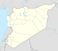
Bara or al-Bara (Arabic: بارة) is one of the former "Dead Cities" in northwestern Syria. It is located in the Zawiya Mountain approximately 65 kilometres (40 mi) north from Hama and approx. 80 km southwest from Aleppo. Al-Bara is also a town in Ariha district. According to the Syria Central Bureau of Statistics (CBS), al-Bara had a population of 10,353 in the 2004 census. Its population is mostly Sunni Muslim.[1]
- ^ a b General Census of Population and Housing 2004 Archived 1 February 2016 at the Wayback Machine. Syria Central Bureau of Statistics (CBS). Idlib Governorate. (in Arabic)
