Back مقاطعة بيتز (ميزوري) Arabic Bates County, Missouri BAR Бейтс (окръг) Bulgarian বাটেস কাউন্টি, মিসৌরি BPY Bates Gông (Missouri) CDO Бейтс (гуо, Миссури) CE Bates County CEB Bates County, Missouri CY Bates County German Κομητεία Μπέιτς (Μιζούρι) Greek
Bates County | |
|---|---|
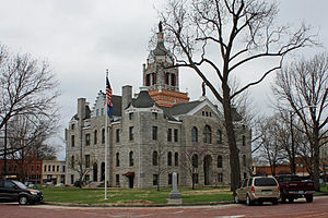
 Bates County Courthouse in Butler | |
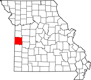
 Location within the U.S. state of Missouri | |
 Missouri's location within the U.S. | |
| Coordinates: 38°16′N 94°20′W / 38.26°N 94.34°W | |
| Country | |
| State | |
| Founded | January 29, 1841[1] |
| Named for | Frederick Bates |
| Seat | Butler |
| Largest city | Butler |
| Area | |
• Total | 851 sq mi (2,200 km2) |
| • Land | 837 sq mi (2,170 km2) |
| • Water | 15 sq mi (40 km2) 1.7% |
| Population (2020) | |
• Total | 16,042 |
| • Density | 19/sq mi (7.3/km2) |
| Time zone | UTC−6 (Central) |
| • Summer (DST) | UTC−5 (CDT) |
| Congressional district | 4th |
| Website | www |
Bates County is a county located in the west central part of the U.S. state of Missouri, two counties south of the Missouri River and is part of the Kansas City metropolitan area. As of the 2020 census, the population was 16,042.[2] Its county seat is Butler.[3] The county was organized in 1841 and named after Frederick Bates, the second Governor of Missouri.[4]
This mostly rural county has an overwhelmingly ethnic European-American population, which has declined in number since the early 20th century as people have moved to cities.
- ^ "Bates County History". Bates County. Archived from the original on December 21, 2017. Retrieved November 23, 2014.
- ^ "2020 Population and Housing State Data". United States Census Bureau. Retrieved August 27, 2021.
- ^ "Find a County". National Association of Counties. Archived from the original on July 12, 2012. Retrieved June 7, 2011.
- ^ Eaton, David Wolfe (1916). How Missouri Counties, Towns and Streams Were Named. The State Historical Society of Missouri. pp. 208.