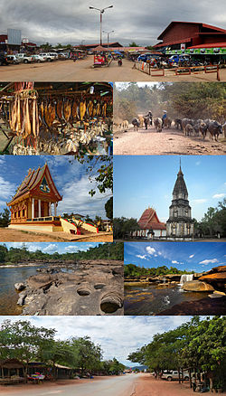
Back Propinsi Bolikhamsai ACE محافظة بوليخاماسي Arabic Bolikhamxai CEB Provinz Bolikhamsai German Provinco Boliĥamsai EO Provincia de Bolikhamxai Spanish استان بولیکامسای FA Bolikhamxai Finnish Province de Borikhamxay French बोलिखमसाइ प्रान्त HI
Bolikhamsai province
ແຂວງ ບໍລິຄໍາໄຊ | |
|---|---|
 | |
 Map of Bolikhamsai province | |
 Location of Bolikhamsai province in Laos | |
| Coordinates: 18°23′00″N 103°39′00″E / 18.383333°N 103.65°E | |
| Country | Laos |
| Capital | Paksan |
| Area | |
• Total | 14,863 km2 (5,739 sq mi) |
| Population (2020 census) | |
• Total | 315,956 |
| • Density | 21/km2 (55/sq mi) |
| Time zone | UTC+7 (ICT) |
| ISO 3166 code | LA-BL |
| HDI (2017) | medium · 4th |
Bolikhamsai (also Borikhamxay, Lao: ບໍລິຄໍາໄຊ, pronounced [bɔ̀ː.lī(ʔ) kʰám.sáj]) is a province of Laos. Pakxan, Thaphabat, Pakkading, Borikhane, Viengthong, and Khamkeut are its districts and Pakxan is its capital city.[2] The province is the site of the Nam Theun 2 Dam, the country's largest hydroelectric project.[3]
Bolikhamsai province covers an area of 14,863 square kilometres (5,739 sq mi).[4] Bolikhansai province borders Xiangkhouang province to the northwest, Vietnam to the east, Khammouane province to the south, and Thailand to the west. The province includes the Annamite Range, stretching east to Vietnam, while to the west are the Mekong River and Thailand. At 3,700 square kilometres (1,400 sq mi), the Nakai-Nam Theun National Park in Bolikhamsai and Khammouane provinces is the third largest protected area in Laos.
- ^ "Sub-national HDI - Area Database - Global Data Lab". hdi.globaldatalab.org. Retrieved 2018-09-13.[not specific enough to verify]
- ^ "Destination: Borikhamxay Province". Laos Tourism Organization. Archived from the original on 13 October 2013. Retrieved 1 December 2012.
- ^ Ray 2009, p. 321.
- ^ "Home". Regions. Official website of Laos Tourism. Archived from the original on 11 January 2013. Retrieved 7 January 2013.