Back مقاطعة كاس (ميزوري) Arabic کاس بؤلگهسی، میزوری AZB Cass County, Missouri BAR Кас (окръг, Мисури) Bulgarian কাস কাউন্টি, মিসৌরি BPY Cass Gông (Missouri) CDO Касс (гуо, Миссури) CE Cass County (kondado sa Tinipong Bansa, Missouri) CEB Cass County (Missouri) Czech Cass County, Missouri CY
Cass County | |
|---|---|
 County courthouse in Harrisonville | |
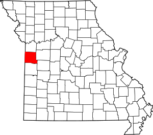
 Location within the U.S. state of Missouri | |
 Missouri's location within the U.S. | |
| Coordinates: 38°39′N 94°21′W / 38.65°N 94.35°W | |
| Country | |
| State | |
| Founded | March 3, 1835 |
| Named for | Lewis Cass |
| Seat | Harrisonville |
| Largest city | Kansas City |
| Government | |
| • County Commission | Presiding Commissioner Bob Huston
Associate Commissioner Monty Kisner Associate Commissioner Jimmy Odom |
| Area | |
• Total | 702 sq mi (1,820 km2) |
| • Land | 697 sq mi (1,810 km2) |
| • Water | 5.7 sq mi (15 km2) 0.8% |
| Population (2020) | |
• Total | 107,824 |
| • Density | 150/sq mi (59/km2) |
| Time zone | UTC−6 (Central) |
| • Summer (DST) | UTC−5 (CDT) |
| Congressional district | 4th |
| Website | www |
Cass County is a county located in the western part of the U.S. state of Missouri and is part of the Kansas City metropolitan area. As of the 2020 census, the population was 107,824.[1] Its county seat is Harrisonville; however, the county contains a portion of Kansas City, Missouri.[2] The county was organized in 1835 as Van Buren County, but was renamed in 1849 after U.S. Senator Lewis Cass of Michigan, who later became a presidential candidate.[3][4]
- ^ "2020 Population and Housing State Data". United States Census Bureau. Retrieved September 8, 2021.
- ^ "Find a County". National Association of Counties. Archived from the original on May 31, 2011. Retrieved June 7, 2011.
- ^ Eaton, David Wolfe (1916). How Missouri Counties, Towns and Streams Were Named. The State Historical Society of Missouri. pp. 272.
- ^ "Disappearing Missouri Names". The Kansas City Star. March 19, 1911. p. 15. Archived from the original on August 19, 2014. Retrieved August 15, 2014 – via Newspapers.com.
