| Chagres Formation | |
|---|---|
| Stratigraphic range: Tortonian-Messinian (Clarendonian-Hemphillian) ~ | |
| Type | Formation |
| Sub-units | Río Indio & Toro Limestone Members |
| Underlies | alluvium |
| Overlies | Gatún Formation |
| Thickness | uncertain |
| Lithology | |
| Primary | Sandstone |
| Other | Siltstone |
| Location | |
| Coordinates | 9°12′N 80°18′W / 9.2°N 80.3°W |
| Approximate paleocoordinates | 9°00′N 79°24′W / 9.0°N 79.4°W |
| Region | Colón Province |
| Country | |
| Extent | Panama Basin |
| Type section | |
| Named for | Chagres River |
| Named by | MacDonald |
| Year defined | 1919 |
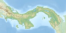
The Chagres Formation (Tc)[1] is a geologic formation in the Colón Province of central Panama. The sandstones and siltstones were deposited in a shallow marine environment and preserve fossils dating back to the Middle to Late Miocene (Tortonian to Messinian, Clarendonian to Hemphillian in the NALMA classification) period.
- ^ Geologic Map, 1980

