This article needs additional citations for verification. (September 2024) |
Choa Chu Kang | |
|---|---|
| Other transcription(s) | |
| • Chinese | 蔡厝港 Càicuògǎng (Pinyin) Chhòa-chhù-káng (Hokkien POJ) Tshuà-tshù-káng(TLPA) |
| • Malay | Choa Chu Kang |
| • Tamil | சுவா சூ காங் Cuvā cū kāṅ (Transliteration) |
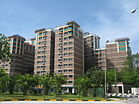
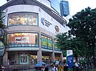
Clockwise from top: Northvale condominium, Lot One Shoppers' Mall, ITE College West, HDB flats in Choa Chu Kang | |
 Location of Choa Chu Kang in Singapore | |
| Coordinates: 1°23′N 103°45′E / 1.383°N 103.750°E | |
| Country | |
| Region | West Region
|
| CDCs | |
| Town Councils |
|
| Constituencies | |
| Government | |
| • Mayors | North West CDC
South West CDC |
| • Members of Parliament | Chua Chu Kang GRC
Marsiling-Yew Tee GRC |
| Area | |
• Total | 6.11 km2 (2.36 sq mi) |
| • Residential | 3.07 km2 (1.19 sq mi) |
| Population | |
• Total | 190,180 |
| • Density | 31,000/km2 (81,000/sq mi) |
| Ethnic groups | |
| • Chinese | 133,520 |
| • Malays | 35,500 |
| • Indians | 18,020 |
| • Others | 5,020 |
| Postal district | 23 |
| Dwelling units | 42,393 |
| Projected ultimate | 62,000 |
Choa Chu Kang (local pronunciation: /ˌtʃwɑː ˌtʃuː ˈkɑːŋ/[a]), alternatively spelled Chua Chu Kang and often abbreviated as CCK, is a planning area and residential town located at the northwestern point of the West Region of Singapore. The town shares borders with Sungei Kadut to the north, Tengah to the southwest, Bukit Batok to the southeast, Bukit Panjang to the east and the Western Water Catchment to the west. Choa Chu Kang New Town is separated into two portions by the Kranji Expressway.
Originally a kampung, the area has been rapidly developed under the ambition of the Housing and Development Board, to transform it into a modern township. The town comprises seven subzones, five of which are the most densely populated: Choa Chu Kang Central, Choa Chu Kang North, Yew Tee, Teck Whye, and Keat Hong.
- ^ a b City Population - statistics, maps and charts | Choa Chu Kang
- ^ a b HDB Key Statistics FY 2014/2015 Archived 4 March 2016 at the Wayback Machine
- ^ a b "Statistics Singapore - Geographic Distribution - Latest Data". Retrieved 10 January 2025.
- ^ "Land Area and Dwelling Units by Town". Data Singapore. 2016. Retrieved 26 January 2018.
Cite error: There are <ref group=lower-alpha> tags or {{efn}} templates on this page, but the references will not show without a {{reflist|group=lower-alpha}} template or {{notelist}} template (see the help page).


