Back مقاطعة كلارك (نيفادا) Arabic Clark County, Nevada BAR Кларк (окръг, Невада) Bulgarian ক্লার্ক কাউন্টি, নেভাডা BPY Clark Gông (Nevada) CDO Кларк (гуо, Невада) CE Clark County (kondado sa Tinipong Bansa, Nevada) CEB Clark County (Nevada) Czech Clark County, Nevada CY Clark County (Nevada) German
Clark County | |
|---|---|
From top, left to right: Caesars Palace panorama, Red Rock Canyon National Conservation Area, Clark County Government Center, Fremont Street Experience, The Venetian, Elephant Rock at Valley of Fire State Park | |
| Motto: "Together for Better" | |
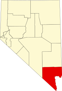
 Location in the state of Nevada | |
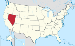
 Nevada in the United States | |
| Coordinates: 36°21′N 115°05′W / 36.350°N 115.083°W | |
| Country | United States |
| State | Nevada |
| Named for | William A. Clark |
| County seat | Las Vegas |
| Largest city (population) | Las Vegas |
| Largest city (area) | Boulder City |
| Government | |
| • Type | Council–Manager |
| • Chair | Tick Segerblom |
| • Vice Chair | William McCurdy II |
| • Clark County Commission | |
| • County Manager | Kevin Schiller |
| Area | |
• Total | 8,061 sq mi (20,880 km2) |
| • Land | 7,891 sq mi (20,440 km2) |
| • Water | 170 sq mi (400 km2) |
| Lowest elevation | 492 ft (150 m) |
| Population (2020) | |
• Total | 2,265,461 |
• Estimate (2023) | 2,336,573 |
| • Density | 280/sq mi (110/km2) |
| GDP | |
| • Total | $160.727 billion (2022) |
| Time zone | UTC−8 (Pacific Time Zone) |
| • Summer (DST) | UTC−7 (Pacific Daylight Time) |
| FIPS code | 003-32003 |
| Website | clarkcountynv |
Clark County is a county located in the U.S. state of Nevada, which also comprises the Las Vegas-Henderson-North Las Vegas, NV metropolitan statistical area. The land area of Clark County is 8,061 square miles (20,880 km2), or roughly the size of New Jersey. As of the 2020 census, the population was 2,265,461. Most of the county population resides in the Las Vegas Census County Divisions, which has 2,196,623 people as of the 2020 Census. [2] It is by far the most populous county in Nevada, and the 11th-most populous county in the United States. It covers 7% of the state's land area but holds 73% of the state's population, making Nevada the most centralized state in the United States.
- ^ "Gross Domestic Product: All Industries in Clark County, NV". fred.stlouisfed.org. Federal Reserve Bank of St. Louis.
- ^ "Urban and Rural". United States Census Bureau. Retrieved March 5, 2023.


