| Cock Beck River Cock | |
|---|---|
 Bridge over the Cock Beck, Aberford | |
| Physical characteristics | |
| Source | |
| • coordinates | 53°50′02″N 1°27′00″W / 53.834°N 1.450°W |
| Mouth | |
• coordinates | 53°52′26″N 1°15′07″W / 53.874°N 1.252°W |
| Length | 25 miles (41 km) |
| Basin size | 27 square miles (71 km2) |
| Basin features | |
| EA waterbody ID | GB104027063940 |
Cock Beck | |||||||||||||||||||||||||||||||||||||||||||||||||||||||||||||||||||||||||||||||||||||||||||||||||||||||||||||||||||||||||||||||||||||||||||||||||||
|---|---|---|---|---|---|---|---|---|---|---|---|---|---|---|---|---|---|---|---|---|---|---|---|---|---|---|---|---|---|---|---|---|---|---|---|---|---|---|---|---|---|---|---|---|---|---|---|---|---|---|---|---|---|---|---|---|---|---|---|---|---|---|---|---|---|---|---|---|---|---|---|---|---|---|---|---|---|---|---|---|---|---|---|---|---|---|---|---|---|---|---|---|---|---|---|---|---|---|---|---|---|---|---|---|---|---|---|---|---|---|---|---|---|---|---|---|---|---|---|---|---|---|---|---|---|---|---|---|---|---|---|---|---|---|---|---|---|---|---|---|---|---|---|---|---|---|---|
| |||||||||||||||||||||||||||||||||||||||||||||||||||||||||||||||||||||||||||||||||||||||||||||||||||||||||||||||||||||||||||||||||||||||||||||||||||
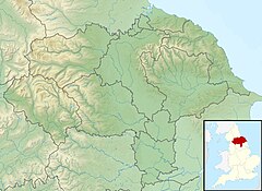
Cock Beck is a stream in the outlying areas of eastern Leeds, West Yorkshire, England, which runs from its source due to a runoff north-west of Whinmoor, skirting east of Swarcliffe and Manston (where a public house has been named 'The Cock Beck'), past Pendas Fields, Scholes, Barwick-in-Elmet, Aberford, Towton, Stutton, and Tadcaster, where it flows into the River Wharfe.
It is a tributary of the River Wharfe, formerly known as the River Cock or Cock River,[1][2] having a much larger flow in the past than it does today.[2] The name 'cock' may refer to a mature salmon, as it was a spawning ground for salmon and trout.[3] Industrial pollution reduced the fish stock, but it has been recovering in the 21st century, aided by work from the Environment Agency.[3] In places the beck was relatively narrow, but too deep to cross unaided; a feature which can still be seen today at many points.
- ^ Langdale, Thomas (1822). A Topographical Dictionary of Yorkshire (2nd ed.). J. Langdale. p. 211.
- ^ a b Armfield, H. M. (2011). A History of Aberford (2nd ed.). available from St Ricarius Church, Aberford. p. 2.
- ^ a b "River cleared for returning salmon". BBC News. 18 December 2002. Retrieved 24 October 2014.

