Back مقاطعة دافيز (يوتا) Arabic داویس بؤلگهسی، یوتا AZB Davis County, Utah BAR Дэйвіс (акруга, Юта) BE Дейвис (окръг, Юта) Bulgarian ডেভিস কাউন্টি, ইউটা BPY Davis Gông (Utah) CDO Дейвис (гуо, Юта) CE Davis County (kondado sa Tinipong Bansa, Utah) CEB Davis County (Utah) Czech
Davis County | |
|---|---|
 Davis County, Utah | |
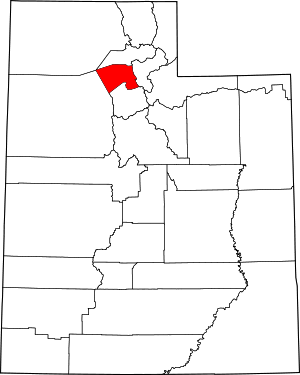
 Location within the U.S. state of Utah | |
 Utah's location within the U.S. | |
| Coordinates: 41°01′N 112°07′W / 41.01°N 112.12°W | |
| Country | |
| State | |
| Founded | October 5, 1850 |
| Named for | Daniel C. Davis |
| Seat | Farmington |
| Largest city | Layton |
| Area | |
• Total | 634 sq mi (1,640 km2) |
| • Land | 299 sq mi (770 km2) |
| • Water | 335 sq mi (870 km2) 53% |
| Population (2020) | |
• Total | 362,679 |
• Estimate (2023) | 373,207 |
| • Density | 1,248/sq mi (482/km2) |
| Time zone | UTC−7 (Mountain) |
| • Summer (DST) | UTC−6 (MDT) |
| Congressional districts | 1st, 2nd |
| Website | www |
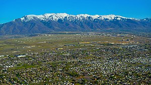
Davis County is a county in northern Utah, United States. As of the 2020 United States Census, the population was 362,679,[1] making it Utah's third-most populous county. Its county seat is Farmington,[2] and its largest city by both population and area is Layton.
Davis County is part of the Ogden-Clearfield, UT Metropolitan Statistical Area as well as the Salt Lake City-Provo-Orem, UT Combined Statistical Area.
- ^ "Davis County, Utah". United States Census Bureau. Retrieved June 30, 2023.
- ^ "Find a County". National Association of Counties. Archived from the original on May 31, 2011. Retrieved June 7, 2011.