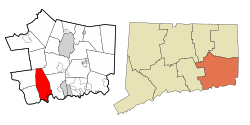
Back إيست لايم (كونيتيكت) Arabic East Lyme Catalan Ист-Лайм (Коннектикут) CE East Lyme, Connecticut CY East Lyme German East Lyme Spanish East Lyme (Connecticut) EU East Lyme French East Lyme, Connecticut HT East Lyme Hungarian
East Lyme, Connecticut | |
|---|---|
| Town of East Lyme | |
 Salt marsh in East Lyme | |
| Coordinates: 41°21′11″N 72°13′46″W / 41.35306°N 72.22944°W | |
| Country | |
| U.S. state | |
| County | New London |
| Region | Southeastern CT |
| Incorporated | 1839 |
| Government | |
| • Type | Selectman-town meeting |
| • First selectman | Dan Cunningham (D) |
| Area | |
• Total | 42.0 sq mi (108.8 km2) |
| • Land | 34.0 sq mi (88.1 km2) |
| • Water | 7.9 sq mi (20.6 km2) |
| Elevation | 210 ft (64 m) |
| Population (2020) | |
• Total | 18,693 |
| • Density | 450/sq mi (170/km2) |
| Time zone | UTC-5 (Eastern) |
| • Summer (DST) | UTC-4 (Eastern) |
| ZIP Codes | 06333, 06357 |
| Area code(s) | 860/959 |
| FIPS code | 09-23400 |
| GNIS feature ID | 0213426 |
| Website | eltownhall |
East Lyme is a town in New London County, Connecticut, United States. The town is part of the Southeastern Connecticut Planning Region. The population was 18,693 at the 2020 census.[1] The villages of Niantic and Flanders are located in the town.
- ^ "Census - Geography Profile: East Lyme town, New London County, Connecticut". United States Census Bureau. Retrieved December 15, 2021.


