Back مقاطعة إدي (نيومكسيكو) Arabic Eddy County, New Mexico BAR Еди (окръг, Ню Мексико) Bulgarian এডি কাউন্টি, নিউ মেক্সিকো BPY Eddy Gông (New Mexico) CDO Эдди (гуо, Нью-Мексико) CE Eddy County (kondado sa Tinipong Bansa, New Mexico) CEB Eddy County, Mecsico Newydd CY Eddy County (New Mexico) German Condado de Eddy (Nuevo México) Spanish
Eddy County | |
|---|---|
 Eddy County Courthouse in Carlsbad | |
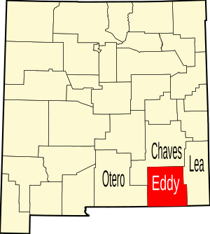
 Location within the U.S. state of New Mexico | |
 New Mexico's location within the U.S. | |
| Coordinates: 32°28′N 104°18′W / 32.47°N 104.3°W | |
| Country | |
| State | |
| Founded | May 16, 1891 |
| Named for | Charles Eddy, a local rancher |
| Seat | Carlsbad |
| Largest city | Carlsbad |
| Area | |
• Total | 4,198 sq mi (10,870 km2) |
| • Land | 4,176 sq mi (10,820 km2) |
| • Water | 22 sq mi (60 km2) 0.5% |
| Population (2020) | |
• Total | 62,314 |
| • Density | 15/sq mi (5.7/km2) |
| Time zone | UTC−7 (Mountain) |
| • Summer (DST) | UTC−6 (MDT) |
| Congressional district | 2nd |
| Website | www |
Eddy County is a county located in the U.S. state of New Mexico. As of the 2020 census, the population was 62,314.[1] Its county seat and largest city is Carlsbad.[2] The county was created in 1891 and later organized in 1892.[3] It is north of the Texas state line.
Eddy County comprises the Carlsbad-Artesia, NM Micropolitan Statistical Area.
Carlsbad Caverns National Park is located in this county. Eddy County is the location of the Waste Isolation Pilot Plant.
- ^ "Eddy County, New Mexico". United States Census Bureau. Retrieved July 3, 2023.
- ^ "Find a County". National Association of Counties. Archived from the original on July 4, 2012. Retrieved June 7, 2011.
- ^ Long, John H., ed. (2007). "New Mexico: Consolidated Chronology of State and County Boundaries". New Mexico Atlas of Historical County Boundaries. The Newberry Library. Archived from the original on August 22, 2016. Retrieved January 2, 2015.