| Colton South Australia—House of Assembly | |||||||||||||||
|---|---|---|---|---|---|---|---|---|---|---|---|---|---|---|---|
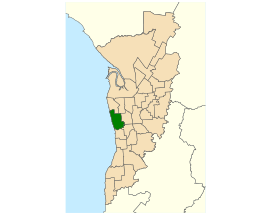
 Electoral district of Colton (green) in the Greater Adelaide area | |||||||||||||||
| State | South Australia | ||||||||||||||
| Created | 1993 | ||||||||||||||
| MP | Matt Cowdrey | ||||||||||||||
| Party | Liberal Party (SA) | ||||||||||||||
| Namesake | Mary Colton | ||||||||||||||
| Electors | 27,600 (2018) | ||||||||||||||
| Area | 26.22 km2 (10.1 sq mi) | ||||||||||||||
| Demographic | Metropolitan | ||||||||||||||
| Coordinates | 34°54′48″S 138°30′40″E / 34.91333°S 138.51111°E | ||||||||||||||
| |||||||||||||||
| Footnotes | |||||||||||||||
| Electoral District map[1] | |||||||||||||||
Colton is a single-member electoral district for the South Australian House of Assembly. It is a 26.2 km2 suburban electorate on Adelaide's western beaches, taking in the suburbs of Adelaide Airport, Fulham, Fulham Gardens, Glenelg North, Henley Beach, Henley Beach South, Kidman Park, West Beach and part of Lockleys.
- ^ Electoral District of Colton (Map). Electoral Commission of South Australia. 2018. Retrieved 1 April 2018.[permanent dead link]
