| Florey South Australia—House of Assembly | |||||||||||||||
|---|---|---|---|---|---|---|---|---|---|---|---|---|---|---|---|
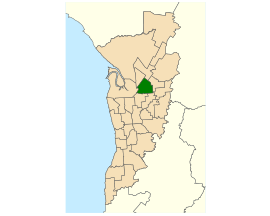
 Electoral district of Florey (green) in the Greater Adelaide area | |||||||||||||||
| State | South Australia | ||||||||||||||
| Created | 1970 | ||||||||||||||
| MP | Michael Brown | ||||||||||||||
| Party | Australian Labor Party | ||||||||||||||
| Namesake | Howard Florey | ||||||||||||||
| Electors | 26,734 (2018) | ||||||||||||||
| Area | 21.25 km2 (8.2 sq mi) | ||||||||||||||
| Demographic | Metropolitan | ||||||||||||||
| Coordinates | 34°49′43″S 138°40′46″E / 34.82861°S 138.67944°E | ||||||||||||||
| |||||||||||||||
| Footnotes | |||||||||||||||
| Electoral District map[1] | |||||||||||||||
Florey is a single-member electoral district for the South Australian House of Assembly. It is named after scientist Howard Florey, who was responsible for the development of penicillin. It is a 21.25 km2 (8.20 sq mi) suburban electorate in Adelaide's north-east, taking in the suburbs of Ingle Farm, Modbury North, Para Vista, Pooraka, Valley View, and Walkley Heights, as well as parts of Modbury and Northfield.
Florey was created at the electoral redistribution of 1969 as a notionally safe Labor electorate, and was first contested at the 1970 election. Mostly it was safely held by the Labor party until the 1989 election when it became the minority Labor government's most marginal electorate. Florey was one of the first electorates to fall to the Liberals at the 1993 election landslide. It was regained by Labor's Frances Bedford at the 1997 election.
- ^ Electoral District of Florey (Map). Electoral Commission of South Australia. 2018. Retrieved 1 April 2018.[permanent dead link]
