Back Eltham (lungsod sa Nuzeland) CEB Eltham (Neuseeland) German Eltham (Nouvelle-Zélande) French エルタム (ニュージーランド) Japanese Eltham, New Zealand Malay Eltham (Nieuw-Zeeland) Dutch Eltham (Nowa Zelandia) Polish Eltham, New Zealand SIMPLE ایلتھم، نیوزی لینڈ UR
Eltham | |
|---|---|
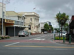
 The town centre of Eltham | |
 | |
| Coordinates: 39°25′47″S 174°17′57″E / 39.42972°S 174.29917°E | |
| Country | New Zealand |
| Region | Taranaki Region |
| Territorial authority | South Taranaki District |
| Ward |
|
| Community | Eltham-Kaponga Community |
| Electorates | |
| Government | |
| • Territorial Authority | South Taranaki District Council |
| • Regional council | Taranaki Regional Council |
| Area | |
• Total | 3.43 km2 (1.32 sq mi) |
| Population (June 2024)[2] | |
• Total | 2,140 |
| • Density | 620/km2 (1,600/sq mi) |
| Postcode | 4322 |
Eltham is a small inland town in South Taranaki, New Zealand, located 50 kilometres (31 mi) south of the city of New Plymouth and southeast of the volcanic cone of Mount Taranaki. Stratford is 11 kilometres (6.8 mi) north, Kaponga 13 km west, and Hāwera is 19 km (12 mi) south. State Highway 3 runs through the town.[3][4]
Eltham is South Taranaki's second largest town.
Eltham is known as the cradle of the Taranaki dairy industry (the co-operative system in particular), and for being the one place in New Zealand that manufactured rennet which is important in cheesemaking.[5] It was also the first place to export butter to England.[6]
- ^ Cite error: The named reference
Areawas invoked but never defined (see the help page). - ^ "Aotearoa Data Explorer". Statistics New Zealand. Retrieved 26 October 2024.
- ^ Peter Dowling, ed. (2004), Reed New Zealand Atlas, Reed Books, map 34, ISBN 0-7900-0952-8.
- ^ Roger Smith, GeographX (2005), The Geographic Atlas of New Zealand, Robbie Burton, map 97, ISBN 1-877333-20-4.
- ^ See The New Zealand Co-operative Rennet Company Limited, Eltham, 50th jubilee, 1916-1966, Hawera, [N.Z.]: n.p., 1966
- ^ "Eltham Travel Guide". Jasons Travel Media. Archived from the original on 2 June 2011. Retrieved 29 May 2011.