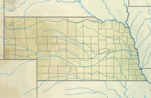
| Fairfield Creek Tributary to Niobrara River | |
|---|---|
| Location | |
| Country | United States |
| State | Nebraska |
| County | Brown Cherry |
| Physical characteristics | |
| Source | Schlagel Creek divide |
| • location | about 4 miles west-northwest of Arabia, Nebraska |
| • coordinates | 42°44′3.01″N 100°27′22.47″W / 42.7341694°N 100.4562417°W[1] |
| • elevation | 2,764 ft (842 m)[1] |
| Mouth | Niobrara River |
• location | about 5.5 miles south of Norden, Nebraska |
• coordinates | 42°47′8.01″N 100°03′46.44″W / 42.7855583°N 100.0629000°W[1] |
• elevation | 2,123 ft (647 m)[1] |
| Length | 24.97 mi (40.19 km)[2] |
| Basin size | 105.16 square miles (272.4 km2)[3] |
| Discharge | |
| • location | Niobrara River |
| • average | 10.25 cu ft/s (0.290 m3/s) at mouth with Niobrara River[3] |
| Basin features | |
| Progression | Niobrara River → Missouri River → Mississippi River → Gulf of Mexico |
| River system | Niobrara |
| Tributaries | |
| • left | unnamed tributaries |
| • right | South Fork Fairfield Creek |
| Waterbodies | Swan Lake |
| Bridges | US 20 |
Fairfield Creek is a 24.97 mi (40.19 km) long third-order tributary to the Niobrara River in Brown County, Nebraska.
- ^ a b c d "Geographic Names Information System". edits.nationalmap.gov. US Geological Survey. Retrieved October 22, 2023.
- ^ "ArcGIS Web Application". epa.maps.arcgis.com. US EPA. Retrieved October 22, 2023.
- ^ a b "Watershed Report | Office of Water | US EPA". watersgeo.epa.gov. US EPA. Retrieved October 22, 2023.


