Back جبل فارالونيس د كالى ARZ Farallones de Cali CEB Farallones de Cali Spanish فارالونز دو کالی FA Farallones de Cali Hungarian Farallones de Cali LLD Farallones de Cali Swedish
| Farallones de Cali | |
|---|---|
| Highest point | |
| Elevation | 4,050 m (13,290 ft) |
| Coordinates | 03°30′29″N 76°41′45″W / 3.50806°N 76.69583°W |
| Geography | |
| Country | Colombia |
| PNN Farallones de Cali | |
|---|---|
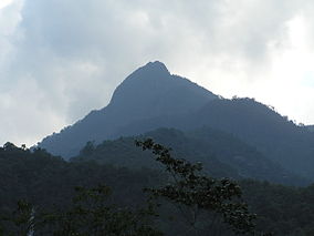
 Pico de Loro (Parrot Peak) | |
 | |
| Nearest city | Cali, Colombia |
| Area | 150,000 ha (580 sq mi) |
| Established | 1968 |
| Governing body | SINAP |
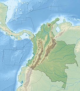
Farallones de Cali is a cluster of mountains in the West Andes of Colombia. It is located west of the city of Cali and gives rise to many of the rivers that provide water and electricity to Cali. The PNN Farallones de Cali encompasses 150,000 ha (580 sq mi) in the mountains as well as much of the Pacific slope and is an area of very high biodiversity. The average temperature ranges from 25 °C (77 °F) in the tropical foothills to 5 °C (41 °F) in the páramo. In this territory are located the district of Pichinde, Andes and Leonera, and two villages Penas Blancas and Lomas de la Cajita.
