Back فروستبورغ Arabic فروستبورج ARZ فروزتبورق، مریلند AZB Frostburg Catalan Фростбург (Мэриленд) CE Frostburg CEB Frostburg, Maryland CY Frostburg (Maryland) German Frostburg (Maryland) Spanish Frostburg (Maryland) EU
Frostburg | |
|---|---|
 View of Frostburg from MD Route 36 near I-68 | |
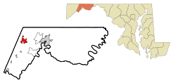
 Location in Maryland | |
| Coordinates: 39°39′02″N 78°55′37″W / 39.65056°N 78.92694°W | |
| Country | |
| State | |
| County | Allegany |
| Incorporated | 1839[1] |
| Government | |
| • Type | City commission government |
| Area | |
• Total | 3.35 sq mi (8.67 km2) |
| • Land | 3.34 sq mi (8.66 km2) |
| • Water | 0.00 sq mi (0.01 km2) |
| Elevation | 1,988 ft (606 m) |
| Population (2020) | |
• Total | 7,027 |
| • Density | 2,101.38/sq mi (811.43/km2) |
| Time zone | UTC−5 (Eastern) |
| • Summer (DST) | UTC−4 (Eastern) |
| ZIP Code | 21532 |
| Area code(s) | 301, 240 |
| FIPS code | 24-30900 |
| GNIS feature ID | 2390589[3] |
| Website | www.frostburgcity.com |
Frostburg is a city in Allegany County, Maryland. It is located at the head of the Georges Creek Valley, 8 miles (13 km) west of Cumberland. The town is one of the first cities on the "National Road", US 40, and the western terminus of the Western Maryland Scenic Railroad. It is part of the Cumberland metropolitan area.
Frostburg was originally called Mount Pleasant until 1820, when the government developed a postal service, and the town was renamed Frostburg. Since 1973, the city has been served by what is now Interstate 68.[4]
The City of Frostburg has an approximate year-round population of 8,075. The total population was 9,002 at the 2010 census. In addition, 5,400 students attend Frostburg State University, a public university within the University System of Maryland.
- ^ "Frostburg". Maryland Manual. Retrieved June 25, 2017.
- ^ "2020 U.S. Gazetteer Files". United States Census Bureau. Retrieved April 26, 2022.
- ^ a b U.S. Geological Survey Geographic Names Information System: Frostburg, Maryland
- ^ Maryland State Highway Administration (August 2, 1991). "Building the National Freeway" (PDF). Maryland Roads. Maryland State Highway Administration: 5.


