Back Fur (pulo) CEB Fur Danish Fur (Insel) German Φουρ (νησί) Greek فور (جزیره) FA Fur French ფური (კუნძული) KA Fur NDS-NL Fur (eiland) Dutch Fur NN
 Cliffs on the island's coastline | |
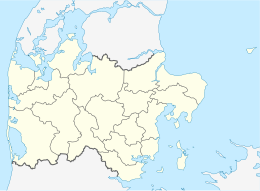
Location in Central Denmark Region | |
| Geography | |
|---|---|
| Location | Limfjord |
| Coordinates | 56°49′54″N 9°1′27″E / 56.83167°N 9.02417°E |
| Area | 21.8 km2 (8.4 sq mi) |
| Length | 8.2 km (5.1 mi) |
| Width | 5.3 km (3.29 mi) |
| Administration | |
| Municipality | Skive Municipality |
| Region | Central Denmark Region |
| Demographics | |
| Population | 752 (2022)[1] |
| Additional information | |
| Postcode | 7884 |
Fur (alternative older spelling: Fuur) is a Danish island in the Limfjord. It is located just north of Salling peninsula in Skive municipality. As of 2022, the island covers an area of 21.8 km2 and has a total population of 752.[1] The village of Nederby is the largest town on the island.
In 2010, readers of the Danish newspaper Kristeligt Dagblad voted for Fur as "Denmark's most wonderful island", ahead of Læsø and Ærø.[2] The island is linked to the mainland through a 24-hour ferry, the Sleipner-Fur ferry, sailing from Branden. The crossing of the Fur Strait takes 3–4 minutes.[3]
- ^ a b "BEF4L Folketal 1. januar efter øer". Statistikbanken (in Danish). Statistics Denmark. 2022. Retrieved 16 March 2023.
- ^ "Her er Danmarks skønneste ø". Berlingske (in Danish). 24 June 2010.
- ^ "Fursund Ferry Service". Fursund Turistinformation. Archived from the original on 2007-04-26. Retrieved 2008-04-14.
