Back Garigal National Park CEB Garigal-Nationalpark German Parque nacional Garigal Spanish Parc national Garigal French Nationaal park Garigal Dutch Garigal National Park Swedish گاریگال نیشنل پارک UR Vườn quốc gia Garigal VI
| Garigal National Park New South Wales | |
|---|---|
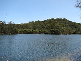
 View of the national park from Middle Harbour | |
| Nearest town or city | Sydney |
| Established | 19 April 1991[1] |
| Area | 22.02 km2 (8.5 sq mi)[1] |
| Managing authorities | NSW National Parks & Wildlife Service |
| Website | Garigal National Park |
| See also | Protected areas of New South Wales |


The Garigal National Park is a protected national park that is located within the North Shore and Forest District regions of Sydney, New South Wales, in eastern Australia. The 2,202-hectare (5,440-acre) national park is situated approximately 20 kilometres (12 mi) north of the Sydney central business district.
Split into three distinct sections, divided by natural geography, urban development and road infrastructure, the park comprises the valley of Middle Harbour Creek and its tributaries, the slopes along the northern side of Middle Harbour as far as Bantry Bay and part of the catchment of Narrabeen Lakes.
The park trails are popular with bushwalkers and mountain bike riders, particularly between Belrose and St Ives in an area known as Cascades after the Cascades Track that runs through the area. There are over 35 trails in the park covering 120km, including both authorised bushwalking and mountain-biking trails, and unofficial or unsanctioned tracks.[2]
- ^ a b "Garigal National Park: Park management". Office of Environment & Heritage. Government of New South Wales. Retrieved 10 October 2014.
- ^ "Guide to Garigal National Park". Hiking the World. Retrieved 19 September 2020.
