Back جغرافيا أرمينيا Arabic Xeografía d'Armenia AST Ermənistan coğrafiyası AZ Геаграфія Арменіі BE География на Армения Bulgarian আর্মেনিয়ার ভূগোল Bengali/Bangla جوگرافیای ئەرمەنستان CKB Γεωγραφία της Αρμενίας Greek Geografio de Armenio EO Geografía de Armenia Spanish


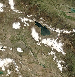
Armenia is a landlocked country in the South Caucasus region of the Caucasus. The country is geographically located in West Asia, within the Armenian plateau.[1][2][3] Armenia is bordered on the north and east by Georgia and Azerbaijan and on the south and west by Iran, Azerbaijan's exclave Nakhchivan, and Turkey.
The terrain is mostly mountainous, with fast flowing rivers and few forests. The climate is highland continental: hot summers and cold winters. The land rises to 4,090 m (13,420 ft) above sea-level at Mount Aragats.
- ^ The UN classification of world regions Archived 25 June 2002 at the Wayback Machine places Armenia in West Asia; the CIA World Factbook "Armenia". The World Factbook. CIA. Retrieved 2 September 2010. "Armenia". National Geographic. Archived from the original on 8 August 2007. Retrieved 16 April 2009., "Armenia". Encyclopædia Britannica. Archived from the original on 1 April 2009. Retrieved 16 April 2009., Calendario Atlante De Agostini (in Italian) (111 ed.). Novara: Istituto Geografico De Agostini. 2015. p. sub voce. ISBN 9788851124908. and Oxford Reference Online "Oxford Reference". World Encyclopedia. Oxford Reference Online. 2004. doi:10.1093/acref/9780199546091.001.0001. ISBN 9780199546091. also place Armenia in Asia.
- ^ "General information about Republic of Armenia". Armenia: Ministry of Foreign Affairs (Armenia). Retrieved October 2, 2023.
The country is situated in western part of Asia, occupies the north-eastern part of Armenian plateau – between Caucasus and Nearest Asia
- ^ Hewsen, Robert H. "The Geography of Armenia" in The Armenian People From Ancient to Modern Times Volume I: The Dynastic Periods: From Antiquity to the Fourteenth Century. Richard G. Hovannisian (ed.) New York: St. Martin's Press, 1997, pp. 1–17