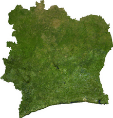
Back جغرافيا ساحل العاج Arabic Xeografía de Costa de Marfil AST Геаграфія Кот-д’Івуара BE কোত দিভোয়ারের ভূগোল Bengali/Bangla Geografía de Costa de Marfil Spanish جغرافیای ساحل عاج FA Géographie de la Côte d'Ivoire French Geografia della Costa d'Avorio Italian Dramblio Kaulo Kranto geografija LT Geografi Ivory Coast Malay
  | |
| Continent | Africa |
|---|---|
| Region | Sub-Sahara |
| Coordinates | 8°0'N, 500'W |
| Area | Ranked 68th |
| • Total | 78,699 km2 (30,386 sq mi) |
| • Land | 4.89% |
| • Water | 95.11% |
| Coastline | 590 km (370 mi) |
| Borders | Total land borders: 3,458 km (2,149 mi) Liberia: 778 km (483 mi) Ghana: 720 km (450 mi) Guinea: 816 km (507 mi) Burkina Faso: 545 km (339 mi) Mali: 599 km (372 mi) |
| Highest point | Mont Nimba 1,752 m (5,748 ft) |
| Lowest point | Gulf of Guinea 0 m/ft (sea level) |
| Longest river | Bandama River |
| Largest lake | Lake Kossou |


Ivory Coast (Côte d'Ivoire) is a sub-Saharan nation in southern West Africa located at 8° N, 5° W. The country is approximately square in shape.