Back جغرافيا نيجيريا Arabic Xeografía de Nixeria AST Геаграфія Нігерыі BE География на Нигерия Bulgarian নাইজেরিয়ার ভূগোল Bengali/Bangla Geografía de Nigeria Spanish جغرافیای نیجریه FA Nigerian maantiede Finnish Géographie du Nigeria French Labarin kasa na Nijeriya HA
 | |
| Continent | Africa |
|---|---|
| Region | West Africa |
| Coordinates | 9°04′55″N 8°40′31″E / 9.0820°N 8.6753°E |
| Area | Ranked 31st |
| • Total | 923,768 km2 (356,669 sq mi) |
| • Land | 98.59% |
| • Water | 1.41% |
| Coastline | 853 km (530 mi) |
| Borders | Total land borders: 4,047 km (2,515 mi) Cameroon: 1,690 km (1,050 mi) Niger: 1,497 km (930 mi) Benin: 773 km (480 mi) Chad: 87 km (54 mi) |
| Highest point | Chappal Waddi 2,419 m (7,936 ft) |
| Lowest point | Atlantic Ocean, 0 m (0 ft) |
| Longest river | Niger River, 1,111.88 km (691 mi) |
| Largest lake | Kainji Lake 1,243 km2 (480 sq mi) |
| Natural resources | petroleum, natural gas, tin, columbite, iron ore, coal, limestone, niobium, lead, zinc, arable land |
| Natural hazards | drought, bush fire, landslide |
| Environmental issues | air pollution, water pollution, oil spillage, lead exposures, poor waste management, deforestation, desertification, erosion, flooding |
| Exclusive economic zone | 217,313 km2 (83,905 sq mi) |


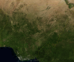
Nigeria is a country in West Africa. It shares land borders with the Republic of Benin to the west, Chad and Cameroon to the east, and Niger to the north.[1] Its coast lies on the Gulf of Guinea in the south and it borders Lake Chad to the northeast. Notable geographical features in Nigeria include the Adamawa Plateau, Mambilla Plateau, Jos Plateau, Obudu Plateau, the Niger River, Benue River, and Niger Delta.
Nigeria is in the tropics, where the climate is very humid and seasonally wet. Nigeria has majorly four climate types; these climate types are generally gradated from south to north. Nigeria's principal streams are the Niger, from which it got its name, and the Benue, the primary tributary of the Niger. The country's most elevated point is Chappal Waddi (or Gangirwal) at 2,419 metres or 7,936 feet, situated in the Adamawa mountains in the Gashaka-Gumti Public Park, Taraba State, on the border with Cameroon.[1]
The capital of Nigeria is Abuja, situated in the centre of the country, while Lagos is the country's major port, monetary center and largest city. Communicated in dialects are English (official), Hausa, Igbo, and Yoruba.[2] It is assessed that Nigeria has around 250 different ethno-etymological gatherings.[3]
- ^ a b nationsonline.org, klaus kästle-. "Nigeria - Country Profile - Nations Online Project". www.nationsonline.org. Retrieved October 3, 2022.
- ^ "Language data for Nigeria". Translators without Borders. Retrieved October 29, 2023.
- ^ "Nigeria - Languages, Dialects, Ethnicities | Britannica". www.britannica.com. Retrieved October 29, 2023.