Back جبال غسيل الجرانيت ARZ Granite Wash Mountains CEB Granite Wash Mountains German Granite Wash Mountains LLD
| Granite Wash Mountains | |
|---|---|
 | |
| Highest point | |
| Peak | Salome Peak |
| Elevation | 3,991 ft (1,216 m)[1] |
| Coordinates | 33°50′22″N 113°42′41″W / 33.83949°N 113.71139°W[2] |
| Dimensions | |
| Length | 8 mi (13 km) NW-SE-(water–divide) |
| Width | 5 mi (8.0 km) |
| Geography | |
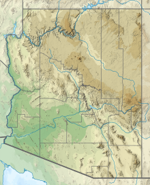
Granite Wash Mountains in Arizona | |
| Country | United States |
| State | Arizona |
| Region(s) | Bouse & Centennial Wash (Maria fold and thrust belt) ((northwest)-Sonoran Desert) |
| District(s) | La Paz County, Arizona, USA |
| Settlement | |
| Range coordinates | 33°50′23″N 113°42′43″W / 33.83972°N 113.71194°W |
| Borders on | Harcuvar Mountains-NE-(attached) Little Harquahala Mountains-SE Ranegras Plain–Bouse Wash-NW & W |
The Granite Wash Mountains are a short, arid, low elevation mountain range of western-central Arizona, in the southeast of La Paz County. The range borders a slightly larger range southeast, the Little Harquahala Mountains; both ranges form a section on the same water divide between two desert washes. The washes flow in opposite directions, one northwest to the Colorado River, the other southeast to the Gila River.
- ^ "Salome Peak, Arizona". Peakbagger.com. Retrieved 2022-11-20.
- ^ "Salome Peak". Geographic Names Information System. United States Geological Survey, United States Department of the Interior. Retrieved 2022-11-20.
