Back مقاطعه جنتور ARZ गुंटूर जिला BH গুণ্টুর জেলা Bengali/Bangla Districte de Guntur Catalan Guntūr (distrito) CEB Guntur (distrikt) Danish Guntur (Distrikt) German Distrikto Guntur EO Distrito de Guntur Spanish Guntur barrutia EU
Guntur district | |
|---|---|
District | |
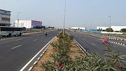
Clockwise from top-left: Lakshmi Narasimha Temple in Mangalagiri, Annamayya Library, Vaikuntapuram temple in Tenali, Chuttugunta centre in Guntur, Flyover in Pedavadlapudi | |
 Location of Guntur district in Andhra Pradesh | |
 | |
| Coordinates (Guntur): 16°18′N 80°27′E / 16.300°N 80.450°E | |
| Country | |
| State | Andhra Pradesh |
| Region | Coastal Andhra |
| Headquarters | Guntur |
| Mandals | 18 |
| Government | |
| • Collector & District Magistrate | Nagalakshmi Selvarajan, I.A.S. [1] |
| • Superintendent of Police | S. Satish Kumar, I.P.S. |
| • Lok Sabha constituency | Guntur |
| • MP | Chandra Sekhar Pemmasani |
| • Assembly constituencies | 07 |
| Area | |
• Total | 2,443 km2 (943 sq mi) |
| • Urban | 130.3 km2 (50.3 sq mi) |
| Population (2011) | |
• Total | 2,091,075 |
| • Density | 860/km2 (2,200/sq mi) |
| • Urban | 1,012,331 |
| Demographics | |
| • Literacy | 67.40% |
| • Sex ratio | 1003 |
| Vehicle registration | AP-07 (former) AP39 (from 30 January 2019)[2] |
| Major highways | NH-16 |
| Website | guntur |
Guntur district is one of the twenty six districts in the Coastal Andhra region of the Indian state of Andhra Pradesh. The administrative seat of the district is located at Guntur, the largest city of the district in terms of area and with a population of 670,073.[3] It has a coastline of approximately 100 km (62 mi) on the right bank of Krishna River, that separates it from Krishna district and NTR district. It is bounded on the south by Bapatla district and on the west by Palnadu district.[4] It has an area of 2,443 km2 (943 sq mi), with a population of 20,91,075, as per 2011 census of India.[5][6]
The district is often referred to as the Land of Chillies.[7] It is also a major centre for agriculture, education and learning. It exports large quantities of chillies and tobacco.[8]
- ^ https://guntur.ap.gov.in/
- ^ "New 'AP 39' code to register vehicles in Andhra Pradesh launched". The New Indian Express. Vijayawada. 31 January 2019. Archived from the original on 21 November 2020. Retrieved 9 June 2019.
- ^ "District – Guntur". Andhra Pradesh Online Portal. Archived from the original on 28 April 2015. Retrieved 23 August 2014.
- ^ "District Profile". National Informatics Centre. Archived from the original on 7 May 2015. Retrieved 27 April 2015.
- ^ "Guntur district". AP state portal. Archived from the original on 15 February 2016. Retrieved 18 January 2016.
- ^ "District Census Handbook – Guntur" (PDF). Census of India. The Registrar General & Census Commissioner. Retrieved 13 May 2016.
- ^ "Guntur district a role model for development". The Hindu. Retrieved 6 June 2017.
- ^ "About Guntur". AP Capital Region Development Authority. Archived from the original on 27 April 2015. Retrieved 27 April 2015.


