Back جوينيد Arabic Гвінед BE Гуинед Bulgarian Kontelezh Gwynedd BR Gwynedd Catalan Gwynedd CEB Gwynedd Czech Gwynedd CY Gwynedd Danish Gwynedd German
This article's lead section contains information that is not included elsewhere in the article. (October 2023) |
Gwynedd | |
|---|---|
 | |
| Motto(s): | |
 Gwynedd shown within Wales | |
| Coordinates: 52°50′N 3°55′W / 52.833°N 3.917°W | |
| Sovereign state | United Kingdom |
| Country | Wales |
| Incorporated | 1 April 1996 |
| Administrative HQ | Council Offices, Caernarfon |
| Government | |
| • Type | Principal council |
| • Body | Gwynedd Council |
| • Control | Plaid Cymru |
| • MPs | 2 MPs |
| • MSs | 2 MSs (Mid and West + North) |
| Area | |
• Total | 979 sq mi (2,535 km2) |
| • Rank | 2nd |
| Population (2022)[2] | |
• Total | 117,591 |
| • Rank | 14th |
| • Density | 120/sq mi (46/km2) |
| Welsh language (2021) | |
| • Speakers | 64.4% |
| • Rank | 1st |
| Time zone | UTC+0 (GMT) |
| • Summer (DST) | UTC+1 (BST) |
| ISO 3166 code | GB-GWN |
| GSS code | W06000002 |
| Website | gwynedd |

Gwynedd (Welsh: [ˈɡwɨnɛð]) is a county in the north-west of Wales. It borders Anglesey across the Menai Strait to the north, Conwy, Denbighshire, and Powys to the east, Ceredigion over the Dyfi estuary to the south, and the Irish Sea to the west. The city of Bangor is the largest settlement, and the administrative centre is Caernarfon. The preserved county of Gwynedd, which is used for ceremonial purposes, includes the Isle of Anglesey.
Gwynedd is the second largest county in Wales but sparsely populated, with an area of 979 square miles (2,540 km2) and a population of 117,400. After Bangor (18,322), the largest settlements are Caernarfon (9,852), Bethesda (4,735), and Pwllheli (4,076). The county has the highest percentage of Welsh speakers in Wales, at 64.4%, and is considered a heartland of the language.[4]
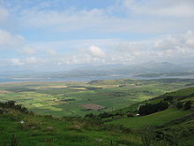
The geography of Gwynedd is mountainous, with a long coastline to the west. The county contains much of Snowdonia (Eryri), a national park which contains Wales's highest mountain, Snowdon (Yr Wyddfa; 3,560 feet, 1,090 m). To the west, the Llŷn Peninsula is flatter and renowned for its scenic coastline, part of which is protected by the Llŷn AONB. Gwynedd also contains several of Wales's largest lakes and reservoirs, including the largest, Bala Lake (Llyn Tegid).
The area which is now the county has played a prominent part in the history of Wales. It formed part of the core of the Kingdom of Gwynedd and the native Principality of Wales, which under the House of Aberffraw remained independent from the Kingdom of England until Edward I's conquest between 1277 and 1283. Edward built the castles at Caernarfon and Harlech, which form part of the Castles and Town Walls of King Edward in Gwynedd World Heritage Site. During the Industrial Revolution the slate industry rapidly developed; in the late nineteenth century the neighbouring Penrhyn and Dinorwic quarries were the largest in the world, and the Slate Landscape of Northwest Wales is now a World Heritage Site. Gwynedd covers the majority of the historic counties of Caernarfonshire and Merionethshire.
- ^ "Council". Gwynedd Council. Retrieved 6 August 2024.
- ^ a b "Mid-Year Population Estimates, UK, June 2022". Office for National Statistics. 26 March 2024. Retrieved 3 May 2024.
- ^ "How life has changed in Gwynedd: Census 2021". Office for National Statistics. 19 January 2023. Retrieved 6 August 2024.
- ^ "How life has changed in Gwynedd: Census 2021". sveltekit-prerender. Retrieved 3 June 2023.
