Back منطقة هافري Arabic हावेरी जिला BH হাবেরী জেলা Bengali/Bangla Haveri (Distrikt) German Distrito de Haveri Spanish بخش هاوری FA District de Haveri French હાવેરી જિલ્લો GU हावेरी जिला HI Distretto di Haveri Italian
This article needs additional citations for verification. (May 2009) |
Haveri district
The Heart of Karnataka | |
|---|---|
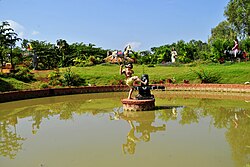
Clockwise from top-right: Galageshwara Temple at Galaganatha, Siddhesvara Temple in Haveri, Rajkumar circle in Utsav Rock Garden, Tarakeshwara Temple at Hanagal, Chaudayyadanapura Mukteshwara temple in Ranebennur | |
| Nickname(s): | |
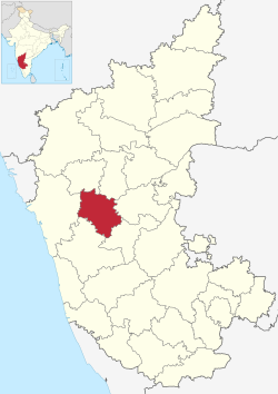
 Location in Karnataka | |
| Coordinates: 14°48′N 75°24′E / 14.8°N 75.4°E | |
| Country | |
| State | |
| Region | Bayaluseeme |
| Division | Kittur Karnataka |
| Headquarters | Haveri |
| Commercial office | Ranebennur |
| Taluks | Byadgi Haveri Hangal Hirekerur Shiggaon Savanur Rattihalli Ranebennur |
| Government | |
| • Deputy Commissioner | Vijaymahantesh Danammanavar |
| Area | |
• Total | 4,823 km2 (1,862 sq mi) |
| • Rank | 18 |
| Population (2011[1]) | |
• Total | 1,597,668 |
| • Density | 330/km2 (860/sq mi) |
| Languages | |
| • Official | Kannada |
| Time zone | UTC+5:30 (IST) |
| PIN | (581110) Haveri
(581115) Ranebennur |
| Telephone code | (08375) (08373)Ranebennur |
| ISO 3166 code | IN-KA |
| Vehicle registration | KA-27 Haveri KA-68 Ranebennur |
| Website | haveri |
Haveri is a district in the state of Karnataka, India.[2] As of 2011, it had a population of 1,597,668, out of which 20.78% were urban residents. The district headquarters is Haveri. Ranebennur is the biggest city in Haveri district with population and the commercial city and business headquarters and seeds production hub.
Name of the place Haveri is derived from two Kannada words "Havu" which means snake and "keri" which means lake together "Havukeri".
- ^ Haveri District : Census 2011 data
- ^ "Hold investors' meet in Haveri". The Hindu. Chennai, India. 17 February 2007. Archived from the original on 24 February 2007. Retrieved 20 November 2008.


