Back هيلسبوروغ Arabic Hillsborough County, New Hampshire BAR Хилсбъроу (окръг, Ню Хампшър) Bulgarian হিলসব্যুরো কাউন্টি, নিউ হ্যাম্পশায়ার BPY Hillsborough Gông (New Hampshire) CDO Хилсборо (гуо, Нью-Гэмпшир) CE Hillsborough County (kondado sa Tinipong Bansa, New Hampshire) CEB Hillsborough County (New Hampshire) Czech Hillsborough County, New Hampshire CY Hillsborough County (New Hampshire) German
Hillsborough County | |
|---|---|
 Manchester skyline | |
 Location within the U.S. state of New Hampshire | |
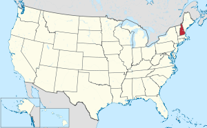
 New Hampshire's location within the U.S. | |
| Coordinates: 42°53′44″N 71°34′58″W / 42.895584°N 71.582741°W | |
| Country | |
| State | |
| Founded | 1769 |
| Named for | The Earl of Hillsborough |
| Seat | Manchester and Nashua |
| Largest city | Manchester (by population) Weare (by area) |
| Area | |
• Total | 892.5 sq mi (2,312 km2) |
| • Land | 876.5 sq mi (2,270 km2) |
| • Water | 15.9 sq mi (41 km2) 1.8% |
| Population (2020) | |
• Total | 422,937 |
• Estimate (2022) | 426,594 |
| • Density | 486.7/sq mi (187.9/km2) |
| Time zone | UTC−5 (Eastern) |
| • Summer (DST) | UTC−4 (EDT) |
| Congressional districts | 1st, 2nd |
| Website | hcnh |
Hillsborough County is the most populous county in the U.S. state of New Hampshire. As of the 2020 census, the population was 422,937,[1] almost one-third the population of the entire state. Its county seats are Manchester and Nashua, the state's two biggest cities. Hillsborough is northern New England's most populous county as well as its most densely populated.
Hillsborough County comprises the Manchester-Nashua, NH Metropolitan Statistical Area, which in turn constitutes a portion of the Boston-Worcester-Providence, MA-RI-NH-CT Combined Statistical Area.
- ^ "State & County QuickFacts". United States Census Bureau. Retrieved April 6, 2023.
