| Holgate Beck | |
|---|---|
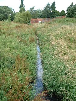
 Holgate Beck flowing through Millennium Green | |
| Etymology | Named after Holgate, the suburb it flows through |
| Location | |
| Country | England |
| City | York |
| Physical characteristics | |
| Source | |
| • location | Askham Bog |
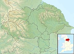
| • coordinates | 53°55′30″N 1°07′30″W / 53.925°N 1.125°W |
| • elevation | 39 feet (12 m) |
| Mouth | |
• location | Water End |
• coordinates | 53°57′54″N 1°06′36″W / 53.965°N 1.110°W |
• elevation | 33 feet (10 m) |
| Length | 4.28 miles (6.88 km) |
| Basin size | 2,650 acres (1,072 ha) |
| Discharge | |
| • location | Water End |
| Basin features | |
| Progression | River Ouse→ Humber Estuary→ North Sea. |
Holgate Beck is a small watercourse that flows north-eastwards through Holgate across the west side of the City of York, England. Primarily flowing through Holgate, from which it derives its name, the beck drains a large part of Askham Bog and Hob Moor, then running underneath the various lines near York railway station. It empties into the River Ouse at Water End, being one of five main tributaries for the River Ouse in York, and consequently added to the flooding in the river and immediate environs. To counter this, some flood diversionary schemes have been implemented near to Askham Bog and Hob Moor.
The Environment Agency list Holgate Beck as a Critical Ordinary Watercourse (COW) due to the potential for flooding from the beck.

