Back جبل چيريموث هيل ARZ Jerimoth Hill CEB Jerimoth Hill German Monteto Jerimoth (Rod-Insulo) EO Jerimoth Hill French Jerimoth Hill LLD ٹلہ جیریموتھ PNB Джеримот-Хилл Russian
| Jerimoth Hill | |
|---|---|
 Jerimoth Hill Summit | |
| Highest point | |
| Elevation | 811 ft (247 m) NGVD 29[1] |
| Prominence | 192 ft (59 m)[1] |
| Listing | U.S. state high point 46th |
| Coordinates | 41°50′58″N 71°46′43″W / 41.8495431°N 71.778681°W[2] |
| Geography | |
| Location | Foster, Rhode Island, US |
| Topo map(s) | USGS East Killingly, CT |
| Climbing | |
| Easiest route | Highway (RI 101) |
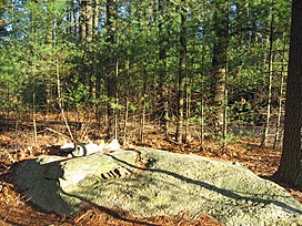
Jerimoth Hill (812 ft, 247 m) is the highest point in the U.S. state of Rhode Island. It is the lowest state highpoint in New England. Located in the town of Foster in the northwest of the state, the site is used as an observatory. It is also a popular destination for highpointers, and prior to 2005 was known for being difficult to access due to a local landowner who prohibited entry.
- ^ a b "Jerimoth Hill, Rhode Island". Peakbagger.com. Retrieved 2010-04-08.
- ^ "Jerimoth Hill". Geographic Names Information System. United States Geological Survey, United States Department of the Interior. Retrieved 2010-04-05.

