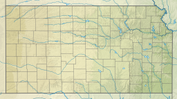
| John Redmond Reservoir | |
|---|---|
| Location | Coffey County, Kansas |
| Coordinates | 38°15′05″N 95°48′10″W / 38.2515043°N 95.8029017°W[1] |
| Type | Reservoir |
| Primary inflows | Neosho River |
| Primary outflows | Neosho River |
| Catchment area | 3,015 sq mi (7,810 km2)[2] |
| Basin countries | United States |
| Managing agency | U.S. Army Corps of Engineers |
| Built | June 18, 1959 |
| First flooded | November 17, 1964 |
| Surface area | 9,400 acres (38 km2)[3] |
| Max. depth | 12 ft (3.7 m)[3] |
| Water volume | Full: 67,302 acre⋅ft (83,016,000 m3) Current (Jan. 2016): 88,024 acre⋅ft (108,576,000 m3)[4] |
| Shore length1 | 59 miles (95 km)[2] |
| Surface elevation | Full: 1,041 ft (317 m) Current (Jan. 2016): 1,043 ft (318 m)[4] |
| Islands | 3 on South section |
| Settlements | Burlington, New Strawn, Ottumwa |
| References | [2][1] |
| 1 Shore length is not a well-defined measure. | |
John Redmond Reservoir is a reservoir on the Neosho River in eastern Kansas.[1] Built and managed by the U.S. Army Corps of Engineers, it is used for flood control, recreation, water supply, and wildlife management.[5] It borders the Flint Hills National Wildlife Refuge to the northwest.[6]

- ^ a b c "John Redmond Reservoir". Geographic Names Information System. United States Geological Survey, United States Department of the Interior. Retrieved January 15, 2021.
- ^ a b c "John Redmond Report" (PDF). Kansas Water Office. Retrieved March 28, 2009.
- ^ a b Cite error: The named reference
Fishingwas invoked but never defined (see the help page). - ^ a b "JRLK1: John Redmond Lake". U.S. Army Corps of Engineers. Retrieved January 7, 2016.
- ^ Cite error: The named reference
Pertinentwas invoked but never defined (see the help page). - ^ Cite error: The named reference
KDOTwas invoked but never defined (see the help page).

