Back Karlobag BS Karlobag CEB Karlobag Czech Karlobag German Karlobag Spanish Karlobag EU کارلوباگ FA Karlobag French Karlobag Croatian Karlobag Hungarian
Karlobag | |
|---|---|
| Općina Karlobag Municipality of Karlobag | |
 | |
| Coordinates: 44°31′29″N 15°04′25″E / 44.52472°N 15.07361°E | |
| Country | |
| County | |
| Area | |
| 280.8 km2 (108.4 sq mi) | |
| • Urban | 0.7 km2 (0.3 sq mi) |
| Population (2021)[2] | |
| 780 | |
| • Density | 2.8/km2 (7.2/sq mi) |
| • Urban | 368 |
| • Urban density | 530/km2 (1,400/sq mi) |
| Demonym(s) | Karlobažanin (male) Karlobažanka (female) |
| Time zone | UTC+1 (CET) |
| • Summer (DST) | UTC+2 (CEST) |
| Postal codes | 53288 Karlobag |
| Vehicle registration | GS |
| Website | karlobag |
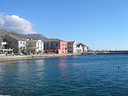
Karlobag (Italian: Carlopago) is a seaside municipality on the Adriatic coast in Croatia, located underneath the Velebit mountains overlooking the island of Pag, west of Gospić and south of Senj. The Gacka river also runs through the area.
In the 2011 census, the population of the municipality was 917, in the following settlements:[3]
- Barić Draga, population 125
- Baške Oštarije, population 27
- Cesarica, population 123
- Crni Dabar, no population
- Došen Dabar, no population
- Karlobag, population 468
- Konjsko, no population
- Kućišta Cesarička, population 12
- Ledenik Cesarički, population 20
- Lukovo Šugarje, population 68
- Ravni Dabar, no population
- Staništa, population 6
- Sušanj Cesarički, population 12
- Vidovac Cesarički, population 56
In the same census, Croats made up the majority at 94.33%.[4]
Today, chief occupations are fishing and tourism. Main activities include boating and hiking, as Karlobag is known for its excellent trails. The Velebit mountains rising above Karlobag have been declared the a world biosphere reserve, currently the only one in Croatia.
- ^ Register of spatial units of the State Geodetic Administration of the Republic of Croatia. Wikidata Q119585703.
- ^ "Population by Age and Sex, by Settlements" (xlsx). Census of Population, Households and Dwellings in 2021. Zagreb: Croatian Bureau of Statistics. 2022.
- ^ "Population by Age and Sex, by Settlements, 2011 Census: Karlobag". Census of Population, Households and Dwellings 2011. Zagreb: Croatian Bureau of Statistics. December 2012.
- ^ "Population by Ethnicity, by Towns/Municipalities, 2011 Census: County of Lika-Senj". Census of Population, Households and Dwellings 2011. Zagreb: Croatian Bureau of Statistics. December 2012.
