Back شرق نيمار Arabic খাণ্ডোয়া জেলা Bengali/Bangla East Nimār CEB Khandwa (Distrikt) German Distrito de Khandwa Spanish بخش خندوا FA District de Khandwa French ખંડવા જિલ્લો GU खंडवा ज़िला HI Distretto di Khandwa Italian
Khandwa district | |
|---|---|
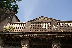
Clockwise from top-left: Ghats of Mandhata, Mamleshwar temple, Omkareshwar Dam, Gauri Kunj, Khandwa railway station | |
 Location of Khandwa district in Madhya Pradesh | |
| Country | |
| State | Madhya Pradesh |
| Division | Indore |
| Headquarters | Khandwa |
| Tehsils | Khandwa Pandhana |
| Government | |
| • Lok Sabha constituencies | Khandwa |
| • Vidhan Sabha constituencies | Mandhata (175) Harsud (176) Khandwa (177) Pandhana (178) |
| Area | |
• Total | 6,206 km2 (2,396 sq mi) |
| Population (2011) | |
• Total | 1,310,061 |
| • Density | 210/km2 (550/sq mi) |
| Demographics | |
| • Literacy | 67.53 per cent |
| • Sex ratio | 944 |
| Time zone | UTC+05:30 (IST) |
| Major highways | Khandwa-Indore State Highway Khandwa-Mundi-Ashta State Highway Khandwa-Amrawati Road |
| Website | khandwa |
Khandwa district (Hindi pronunciation: [kʰəɳɖʋaː]), formerly known as the East Nimar district, is a district of the Madhya Pradesh state in central India. The city of Khandwa is the administrative headquarters of the district. Other notable towns in the district include Mundi, Harsud, Punasa, Pandhana and Omkareshwar.


