Back بحيرة سكيوتاري Arabic Şkoder gölü AZ Скадарскае возера BE Скадарскае возера BE-X-OLD Шкодренско езеро Bulgarian Skadarsko jezero BS Llac Skadar Catalan Skadarské jezero Czech Скадар кӳлли CV Shkodërsøen Danish
| Lake Skadar | |
|---|---|
| Lake Scutari, Lake Shkodër, Lake Shkodra | |
 Lake Skadar and Mount Maranaj (1,576 m) in Albania | |
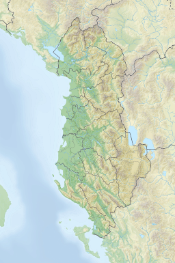
| Location | Albania–Montenegro border |
| Coordinates | 42°10′N 19°19′E / 42.167°N 19.317°E |
| Primary inflows | Morača |
| Primary outflows | Buna |
| Basin countries | Albania, Montenegro |
| Max. length | 44 km (27 mi) |
| Max. width | 14 km (8.7 mi) |
| Surface area | 370–530 km2 (140–200 sq mi) |
| Average depth | 5.01 m (16.4 ft) |
| Max. depth | 8.3 m (27 ft)[1] 44 m (144 ft)[citation needed] |
| Water volume | 1,931.62×106 m3 (68.215×10⁹ cu ft) |
| Shore length1 | 207 km (129 mi) is total length of coastline (including islands). |
| Surface elevation | 6 m (20 ft) |
| References | [1] |
| Official name | Skadarsko Jezero |
| Designated | 13 December 1995 |
| Reference no. | 784[2] |
| Official name | Lake Shkodra and River Buna |
| Designated | 2 February 2006 |
| Reference no. | 1598[3] |
| 1 Shore length is not a well-defined measure. | |
Lake Skadar or Lake Scutari (Albanian: Liqeni i Shkodrës, pronounced [liˈcɛni i ˈʃkɔdrəs]; Montenegrin: Скадарско језеро, Skadarsko jezero, pronounced [skâdarskɔː jɛ̂zɛrɔ]) – also called Lake Shkodra (and Lake Shkodër) – lies on the border of Albania and Montenegro, and is the largest lake in Southern Europe. It is named after the Albanian city of Shkodër which lies at its southeastern coast. It is a karst lake.
The Montenegrin section of the lake and surrounding land have been designated as a national park, while the Albanian part constitutes a nature reserve and a Ramsar site.
- ^ a b Pešić V. & Glöer P. (2013). "A new freshwater snail genus (Hydrobiidae, Gastropoda) from Montenegro, with a discussion on gastropod diversity and endemism in Skadar Lake". ZooKeys 281: 69-90. doi:10.3897/zookeys.281.4409
- ^ "Skadarsko Jezero". Ramsar Sites Information Service. Retrieved 25 April 2018.
- ^ "Lake Shkodra and River Buna". Ramsar Sites Information Service. Retrieved 25 April 2018.

