Back ليوود Arabic ليوود ARZ لیوود، کانزاس AZB Leawood (Kansas) Catalan Ливуд (Канзас) CE Leawood (lungsod sa Tinipong Bansa, Kansas) CEB لیوود CKB Leawood (Kansas) German Leawood (Kansas) Spanish Leawood (Kansas) EU
Leawood, Kansas | |
|---|---|
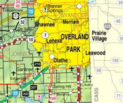
 Location within Johnson County and Kansas | |
 | |
| Coordinates: 38°54′27″N 94°37′33″W / 38.90750°N 94.62583°W[1] | |
| Country | United States |
| State | Kansas |
| County | Johnson |
| Founded | 1920s |
| Incorporated | 1948 |
| Named for | Oscar Lee |
| Government | |
| • Mayor | Marc Elkins[2] |
| Area | |
• Total | 15.21 sq mi (39.38 km2) |
| • Land | 15.11 sq mi (39.12 km2) |
| • Water | 0.10 sq mi (0.26 km2) |
| Elevation | 958 ft (292 m) |
| Population | |
• Total | 33,902 |
| • Density | 2,200/sq mi (860/km2) |
| Time zone | UTC-6 (CST) |
| • Summer (DST) | UTC-5 (CDT) |
| ZIP code | 66206, 66207, 66209, 66211, 66224 [6] |
| Area code | 913 |
| FIPS code | 20-39075 |
| GNIS ID | 485611[1] |
| Website | leawood.org |
Leawood (/ˈliːwʊd/) is a city in Johnson County, Kansas, United States,[1] and is part of the Kansas City metropolitan area. As of the 2020 census, the population of the city was 33,902.[4][5]
- ^ a b c d U.S. Geological Survey Geographic Names Information System: Leawood, Kansas
- ^ "Members". City of Leawood. Retrieved March 1, 2024.
- ^ "2019 U.S. Gazetteer Files". United States Census Bureau. Retrieved July 24, 2020.
- ^ a b "Profile of Leawood, Kansas in 2020". United States Census Bureau. Archived from the original on November 23, 2022. Retrieved November 22, 2022.
- ^ a b "QuickFacts; Leawood, Kansas; Population, Census, 2020 & 2010". United States Census Bureau. Archived from the original on August 24, 2021. Retrieved August 23, 2021.
- ^ United States Postal Service (2012). "USPS - Look Up a ZIP Code". Retrieved February 15, 2012.