Back منطقة لونجلي Arabic لونجلى ARZ লুংলেই জিলা AS लुंगलेई जिला BH লুংলেই জেলা Bengali/Bangla Lunglei (distrito) CEB Lunglei (Distrikt) German Distrito de Lunglei Spanish Lunglei barrutia EU بخش لونگلی FA
Lunglei district | |
|---|---|
 View of Lunglei town | |
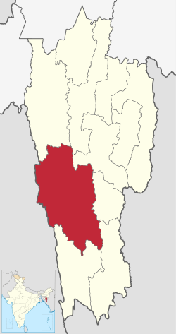
 Location in Mizoram | |
| Country | India |
| State | Mizoram |
| Headquarters | Lunglei |
| Government | |
| • Lok Sabha constituencies | Mizoram |
| • Vidhan Sabha constituencies | 7 |
| Area | |
• Total | 4,536 km2 (1,751 sq mi) |
| Population (2001) | |
• Total | 161,428 |
| • Density | 36/km2 (92/sq mi) |
| Demographics | |
| • Literacy | 88.86 |
| • Sex ratio | 947 |
| Time zone | UTC+05:30 (IST) |
| Website | lunglei |
Lunglei district is one of the eleven districts of Mizoram state in India. As of 2011[update] it is the second most populous district in the state, after Aizawl.[1]
