Back مقاطعة ماناتي (فلوريدا) Arabic مانئیت بؤلگهسی، فلوریدا AZB Manatee County, Florida BAR Манъти (окръг, Флорида) Bulgarian মানাটী কাউন্টি, ফ্লোরিডা BPY Manatee Gông (Florida) CDO Мэнати (гуо, Флорида) CE Manatee County CEB Manatee County, Florida CY Manatee County German
Manatee County | |
|---|---|
 Manatee County Administration Building | |
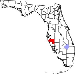
 Location within the U.S. state of Florida | |
 Florida's location within the U.S. | |
| Coordinates: 27°29′N 82°22′W / 27.48°N 82.36°W | |
| Country | |
| State | |
| Founded | January 9, 1855 |
| Named for | Florida manatee |
| Seat | Bradenton |
| Largest city | Bradenton |
| Area | |
• Total | 893 sq mi (2,310 km2) |
| • Land | 743 sq mi (1,920 km2) |
| • Water | 150 sq mi (400 km2) 16.8% |
| Population (2020) | |
• Total | 399,710 |
| • Density | 538/sq mi (208/km2) |
| Time zone | UTC−5 (Eastern) |
| • Summer (DST) | UTC−4 (EDT) |
| Area code | 941 |
| Congressional district | 16th |
| Website | www |
Manatee County is a county in the U.S. state of Florida. As of the 2020 U.S. Census, the population was 399,710.[1] Manatee County is part of the North Port-Bradenton-Sarasota, Florida Metropolitan Statistical Area. Its county seat and largest city is Bradenton.[2] The county was created in 1855 and named for the Florida manatee,[3] Florida's official marine mammal. Features of Manatee County include access to the southern part of the Tampa Bay estuary, the Sunshine Skyway Bridge, and the Manatee River.
- ^ "State & County QuickFacts". United States Census Bureau. Retrieved February 20, 2020.
- ^ "Find a County". National Association of Counties. Retrieved June 7, 2011.
- ^ Publications of the Florida Historical Society. Florida Historical Society. 1908. p. 33.

