Back Maursmünster ALS مارموتير Arabic مارموتير ARZ Marmoutier Catalan МагӀмутье CE Marmoutier CEB Marmoutier German Marmoutier DIQ Marmoutier EO Marmoutier Spanish
- See Marmoutier Abbey (Tours) for the former abbey in Tours.
Marmoutier
Màschmínschter | |
|---|---|
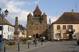
 Former abbey church of Marmoutier Abbey | |
| Coordinates: 48°41′N 7°23′E / 48.69°N 7.38°E | |
| Country | France |
| Region | Grand Est |
| Department | Bas-Rhin |
| Arrondissement | Saverne |
| Canton | Saverne |
| Intercommunality | Pays de Saverne |
| Government | |
| • Mayor (2020–2026) | Jean-Claude Weil[1] |
Area 1 | 14.07 km2 (5.43 sq mi) |
| Population (2022)[2] | 2,703 |
| • Density | 190/km2 (500/sq mi) |
| Time zone | UTC+01:00 (CET) |
| • Summer (DST) | UTC+02:00 (CEST) |
| INSEE/Postal code | 67283 /67440 |
| Elevation | 188–367 m (617–1,204 ft) (avg. 210 m or 690 ft) |
| 1 French Land Register data, which excludes lakes, ponds, glaciers > 1 km2 (0.386 sq mi or 247 acres) and river estuaries. | |
Marmoutier (French pronunciation: [maʁmutje] ⓘ; German: Maursmünster) is a commune in the Bas-Rhin département in Grand Est in north-eastern France.[3] The origin of the place is the former Marmoutier Abbey, of which the abbey church still serves as the parish church.
- ^ "Répertoire national des élus: les maires" (in French). data.gouv.fr, Plateforme ouverte des données publiques françaises. 13 September 2022.
- ^ "Populations de référence 2022" (in French). The National Institute of Statistics and Economic Studies. 19 December 2024.
- ^ INSEE commune file


