Back النبطية Arabic النبطيه ARZ Эн-Набатыя BE নবতিয়া Bengali/Bangla Nabatieh CEB Nabatäa (Stadt) German Ναμπατίγια Greek An-Nabaţīyah at-Taḩtā ET Nabatieh EU نبطیه FA
Nabatieh
النبطية | |
|---|---|
City | |
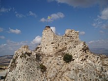
 Nabatieh, 2006 | |
| Coordinates: 33°21′50″N 35°29′15″E / 33.36389°N 35.48750°E | |
| Grid position | 125/160 L |
| Country | |
| Governorate | Nabatieh Governorate |
| District | Nabatieh District |
| Area | |
• City | 8 km2 (3 sq mi) |
| • Metro | 21 km2 (8 sq mi) |
| Elevation | 418 m (1,371 ft) |
| Population | |
• City | 40,000 |
| • Metro | 85,000 |
| Time zone | UTC+2 (EET) |
| • Summer (DST) | UTC+3 (EEST) |
| Dialing code | +961 |
Preview warning: Page using Template:Infobox settlement with unknown parameter "Other name"


Nabatieh (Arabic: النبطية, Nabaṭiyya, Syriac-Aramaic: ܐܠܢܒܛܝܥ), or Nabatîyé (IPA: [ˈnabatˤɪje]), is the city of the Nabatieh Governorate, in southern Lebanon.
