Back نهر ناوجاتوك ARZ Naugatuck River CEB Naugatuck River German Naugatuck River NB Ноґатак (притока Гузатоніку) Ukrainian
| Naugatuck River | |
|---|---|
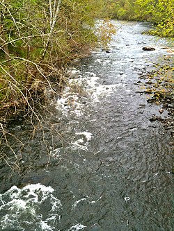
 Naugatuck River in Oakville from Whitestone Cliffs Trail road walk over Frost Bridge - CT Route 262 | |
 | |
| Native name | Neggutuck (Algonquin)[2] |
| Location | |
| Country | United States |
| State | Connecticut |
| Region | Litchfield County and New Haven County |
| Cities | Torrington, Litchfield, Harwinton, Thomaston, Watertown, Waterbury, Naugatuck, Beacon Falls, Seymour, Ansonia, Derby |
| Physical characteristics | |
| Source | |
| • location | Confluence of West and East Branches Naugatuck River in Torrington, Connecticut |
| • coordinates | 41°47′49″N 073°07′00″W / 41.79694°N 73.11667°W[3] |
| • elevation | 526 ft (160 m)[4] |
| Mouth | Confluence with Housatonic River |
• location | Derby, Connecticut |
• coordinates | 41°18′49″N 073°04′50″W / 41.31361°N 73.08056°W[3] |
• elevation | 3 ft (0.91 m)[3] |
| Basin features | |
| Tributaries | |
| • left | East Branch Naugatuck River, Leadmine Brook, Spruce Brook, Hancock Brook, Mad River, Hockanum Brook, Bladens River |
| • right | West Branch Naugatuck River, Northfield Brook, Branch Brook, Steele Brook, Hop Brook, Little River, Long Meadow Pond Brook[5] |
The Naugatuck River is a 40.2-mile-long (64.7 km)[4] river in the U.S. state of Connecticut. Its waters carve out the Naugatuck River Valley in the western reaches of the state, flowing generally due south and eventually emptying into the Housatonic River at Derby, Connecticut and thence 11 miles (18 km) to Long Island Sound. The Plume and Atwood Dam in Thomaston, completed in 1960 following the Great Flood of 1955, creates a reservoir on the river and is the last barrier to salmon and trout migrating up from the sea.[6]
- ^ Cite error: The named reference
Hugheswas invoked but never defined (see the help page). - ^ a b William Bright (2007). Native American Placenames of the United States. University of Oklahoma Press. p. 318. ISBN 978-0806135984. Retrieved 2014-11-02.
- ^ a b c "Naugatuck River". Geographic Names Information System. United States Geological Survey, United States Department of the Interior.
- ^ a b U.S. Geological Survey. National Hydrography Dataset high-resolution flowline data. The National Map Archived 2012-03-29 at the Wayback Machine, accessed April 1, 2011
- ^ "Long Meadow Pond Brook-Naugatuck River Statistics". UConn Center for Land Use Education & Research. Archived from the original on 2017-04-07.
- ^ "Fish and Habitat". Housatonic Valley Association. Archived from the original on 2014-11-03. Retrieved 2014-11-03.