Back مقاطعة نيو هيفن (كونيتيكت) Arabic Condáu de New Haven AST New Haven County, Connecticut BAR Ню Хейвън (окръг, Кънектикът) Bulgarian নিউ হেভেন কাউন্টি, কানেকটিকাট BPY New Haven Gông (Connecticut) CDO Нью-Хейвен (гуо, Коннектикут) CE New Haven County CEB New Haven County, Connecticut CY New Haven County German
New Haven County | |
|---|---|
 | |
 Location within the U.S. state of Connecticut | |
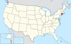
 Connecticut's location within the U.S. | |
| Coordinates: 41°21′N 72°54′W / 41.35°N 72.9°W | |
| Country | |
| State | |
| Founded | 1666 |
| Named for | New Haven Colony |
| Seat | none (since 1960) New Haven (before 1960) |
| Largest municipality | New Haven (population) Guilford (area) |
| Area | |
• Total | 862 sq mi (2,230 km2) |
| • Land | 605 sq mi (1,570 km2) |
| • Water | 258 sq mi (670 km2) 29.9% |
| Population (2020) | |
• Total | 864,835 |
| • Density | 1,429.5/sq mi (551.9/km2) |
| Time zone | UTC−5 (Eastern) |
| • Summer (DST) | UTC−4 (EDT) |
| Congressional districts | 2nd, 3rd, 4th, 5th |
New Haven County is a county in the south central part of the U.S. state of Connecticut. As of the 2020 census, the population was 864,835,[1] making it the third-most populous county in Connecticut. Two of the state's five largest cities, New Haven (3rd) and Waterbury (5th), are part of New Haven County.
New Haven County is part of the New Haven-Milford, CT Metropolitan Statistical Area, which is included in the New York metropolitan Combined Statistical Area.
County governments were abolished in Connecticut in 1960. Thus, as is the case with all eight of Connecticut's counties, there is no county government, and no county seat. Until 1960, the city of New Haven was the county seat. In Connecticut, towns are responsible for all local government activities, including fire and rescue, snow removal and schools. In some cases, neighboring towns will share certain activities, e.g. schools, health, etc. New Haven County is merely a group of towns on a map, and has no specific government authority. The county Sheriff system was abolished by voters and replaced by State Judicial Marshals in 2000. As a result, the state judicial system in New Haven County has three judicial districts: New Haven, Ansonia-Milford, and Waterbury. On June 6, 2022, the U.S. Census Bureau formally recognized Connecticut's nine councils of governments as county equivalents instead of the state's eight counties. Connecticut's eight historical counties continue to exist in name only, and are no longer considered for statistical purposes.[2]
- ^ "Census - Geography Profile: New Haven County, Connecticut". United States Census Bureau. Archived from the original on November 21, 2021. Retrieved November 20, 2021.
- ^ https://www.federalregister.gov/documents/2022/06/06/2022-12063/change-to-county-equivalents-in-the-state-of-connecticut Archived January 20, 2023, at the Wayback Machine Federal Register: Change to County-Equivalents in the State of Connecticut
