| Bonne Bay Road | ||||
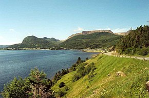
 Route 431 in Gros Morne National Park | ||||
| Route information | ||||
| Maintained by Newfoundland and Labrador Department of Transportation and Infrastructure | ||||
| Length | 50.7 km (31.5 mi) | |||
| Major junctions | ||||
| West end | Main Street in Trout River | |||
| East end | ||||
| Location | ||||
| Country | Canada | |||
| Province | Newfoundland and Labrador | |||
| Highway system | ||||
|
| ||||
| ||||
Route 431, also known as Bonne Bay Road, is a short highway almost entirely within Gros Morne National Park on the island of Newfoundland in the Canadian province of Newfoundland and Labrador. It begins at a junction of Route 430 in Wiltondale and terminates at Trout River. It serves the town of Woody Point on Bonne Bay and passes through the communities of Glenburnie, Birchy Head and Winter House Brook.[1]
- ^ "Route 431" (Map). Google Maps. Retrieved May 24, 2020.

