Back North Stradbroke Island CEB North Stradbroke Island German جزیره استردبروک شمالی FA Île Stradbroke-Nord French North Stradbroke Island Italian ノースストラドブローク島 Japanese North Stradbroke-eiland Dutch North Stradbroke Island Polish Норт-Страдброк Russian North Stradbroke Island Swedish
Native name: Minjerribah Nickname: Straddie | |
|---|---|
 NASA World Wind Landsat montage | |
 | |
| Geography | |
| Location | Moreton Bay |
| Coordinates | 27°35′S 153°28′E / 27.583°S 153.467°E |
| Area | 275.2 km2 (106.3 sq mi) |
| Length | 38 km (23.6 mi) |
| Width | 11 km (6.8 mi) |
| Highest elevation | 239 m (784 ft) |
| Administration | |
Australia | |
| State | Queensland |
| Region | South East Queensland |
| Metropolis | Brisbane |
| Local government area | Redland City |
| Demographics | |
| Population | 2026 (2011 census) |
| Ethnic groups | Quandamooka people |
| Additional information | |
 | |

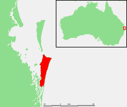
North Stradbroke Island (Jandai: Minjerribah[1]), colloquially Straddie or North Straddie,[2] is an island that lies within Moreton Bay in the Australian state of Queensland, 30 kilometres (19 mi) southeast of the centre of Brisbane. Originally there was only one Stradbroke Island but in 1896 it split into North Stradbroke Island and South Stradbroke Island separated by the Jumpinpin Channel. The Quandamooka people are the traditional owners of North Stradbroke island.[3]
The island is divided into four localities: Dunwich, Amity and Point Lookout are small localities centred on the towns of the same name,[4][5][6] while the remainder of the island is in the locality of North Stradbroke Island.[7] All the localities are within the City of Redland.
At 275.2 square kilometres (106.3 sq mi; 68,000 acres), it is the second largest sand island in the world.[8] On the island there are three small towns, a number of lakes and beaches along most of the seaward coastline with rocky outcrops at Point Lookout. An Aboriginal presence on the island has been long and ongoing, resulting in a successful native title determination. Tourism is a major and growing industry on the island.[9] The island has been the site for sand mining for more than sixty years. Tourism and currently mining are the island's main industries.
- ^ "South Stradbroke Island history". Gold Coast history and heritage. City of Gold Coast. Archived from the original on 17 March 2018. Retrieved 5 October 2015.
- ^ "North Stradbroke Island". Visit Brisbane. Brisbane Marketing Economic Development Board. 2015. Archived from the original on 6 October 2015. Retrieved 5 October 2015.
- ^ "Native title dispute goes to court after Queensland mining lease extended". The Guardian. Australia. 6 June 2014. Archived from the original on 21 May 2017. Retrieved 6 June 2014.
- ^ "Dunwich – locality in City of Redland (entry 43641)". Queensland Place Names. Queensland Government. Retrieved 5 November 2019.
- ^ "Amity – locality in Redland City (entry 43639)". Queensland Place Names. Queensland Government. Retrieved 23 June 2017.
- ^ "Amity – locality (entry 43639)". Queensland Place Names. Queensland Government. Retrieved 23 June 2017.
- ^ "North Stradbroke Island – locality in City of Redland (entry 43646)". Queensland Place Names. Queensland Government. Retrieved 5 November 2019.
- ^ "About North Stradbroke Island". Centre for Marine Studies. University of Queensland. Archived from the original on 2 November 2013. Retrieved 18 August 2010.
- ^ Council, Redland City. "Policies". www.redland.qld.gov.au. Archived from the original on 26 August 2019. Retrieved 26 August 2019.