Back Illa Parola Catalan Northeast Cay (Spratly-Inseln) German Cayo Noreste (Islas Spratly) Spanish Île Parola French ノースイースト島 (南沙諸島) Japanese Beizi Dao Swedish Đảo Song Tử Đông VI 北子岛 Chinese
| Disputed island | |
|---|---|
 Northeast Cay | |
| Other names | Parola Island (Philippine English) Pulo ng Parola (Filipino) Đảo Song Tử Đông (Vietnamese) 北子島 / 北子岛 Běizi Dǎo (Chinese) |
| Geography | |
| Location | South China Sea |
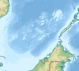
| Coordinates | 11°27′09″N 114°21′16″E / 11.45250°N 114.35444°E |
| Archipelago | Spratly Islands |
| Administration | |
| Region | Southwestern Tagalog Region |
| Province | Palawan |
| Municipality | Kalayaan |
| Claimed by | |
| Additional information | |
 | |


Northeast Cay, also known as Parola Island (Filipino: Pulo ng Parola, lit. 'Island of [the] Lighthouse'; Mandarin Chinese: 北子島/北子岛; pinyin: Běizǐ Dǎo; Vietnamese: Đảo Song Tử Đông), with a land area of 12.7 hectares (31 acres), is the fifth largest of the naturally occurring[1] Spratly Islands and the third largest of the Philippine-occupied islands. It is part of the North Danger Reef and is located to the northwest of Dangerous Ground.
It is 1.75 miles (2.82 km) north of Vietnamese-occupied Southwest Cay (Tagalog: Pugad), and they are visible from each other. It is located 28 miles (45 km) northwest of Philippine-occupied Thitu Island (Pag-asa),[2] and is administered by the Philippines as part of Kalayaan, Palawan.
The island is also claimed by the People's Republic of China, the Republic of China (Taiwan) and Vietnam.
- ^ Note that in 2014 the PRC embarked on a number of reclamation projects in the Spratly Islands. It appears that the largest of these, at Fiery Cross Reef, is of at least 60 hectares and, according to some unverifiable sources, possibly as large as 150 ha.Kristine Kwok and Minnie Chan (2014-06-08). "China plans artificial island in disputed Spratlys chain in South China Sea". South China Morning Post. Retrieved 2014-09-28.
- ^ Campbell, Eric (20 May 2014). "Reef Madness". ABC News. Retrieved 23 May 2014.
