Back مقاطعة أوسيولا (فلوريدا) Arabic وزکئولا بؤلگهسی، فلوریدا AZB Osceola County, Florida BAR Оцеола (окръг, Флорида) Bulgarian ওসসেৱলা কাউন্টি, ফ্লোরিডা BPY Osceola Gông (Florida) CDO Оцеола (гуо, Флорида) CE Osceola County (kondado sa Tinipong Bansa, Florida) CEB Osceola County, Florida CY Osceola County (Florida) German
Osceola County | |
|---|---|
 The Osceola County Courthouse in October 2009 | |
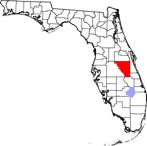
 Location within the U.S. state of Florida | |
 Florida's location within the U.S. | |
| Coordinates: 28°04′N 81°09′W / 28.06°N 81.15°W | |
| Country | |
| State | |
| Founded | May 12, 1887 |
| Named for | Osceola |
| Seat | Kissimmee |
| Largest city | Kissimmee |
| Government | |
| • Chair | Viviana Janer |
| Area | |
• Total | 1,506 sq mi (3,900 km2) |
| • Land | 1,327 sq mi (3,440 km2) |
| • Water | 178 sq mi (460 km2) 11.9% |
| Population | |
• Total | 388,656 |
| • Density | 293/sq mi (113.1/km2) |
| Time zone | UTC−5 (Eastern) |
| • Summer (DST) | UTC−4 (EDT) |
| Congressional district | 9th |
| Website | www |
Osceola County (/ˌɒsiˈoʊlə/ AH-see-OH-lə) is a county located in the central portion of the U.S. state of Florida. As of the 2020 census, the population was 388,656.[1] Its county seat is Kissimmee.[2] Osceola County is included in the Orlando–Kissimmee–Sanford, Fla. Metropolitan Statistical Area.
Being 54.3% Hispanic, Osceola is one of three Hispanic-majority counties in Florida, owing to its large Puerto Rican American population. It also is the 12th-largest majority-Hispanic county in the nation.[3]
- ^ a b "State & County QuickFacts". United States Census Bureau. Retrieved February 14, 2014.[permanent dead link]
- ^ "Find a County". National Association of Counties. Retrieved June 7, 2011.
- ^ "P2: HISPANIC OR LATINO, AND NOT HISPANIC OR LATINO BY RACE". 2020 Census. United States Census Bureau. Retrieved October 10, 2021.


