Back पारसनाथ BH Parasnath Catalan Parasnāth CEB Parasnath German पारसनाथ HI ᱢᱟᱨᱟᱝᱵᱩᱨᱩ SAT Parasnāth Swedish பரஸ்நாத் மலை Tamil
| Parasnath | |
|---|---|
| Shikhar Ji | |
 Parasnath Hill | |
| Highest point | |
| Elevation | 1,365 m (4,478 ft) |
| Listing | List of Indian states and territories by highest point |
| Coordinates | 23°57′48″N 86°07′44″E / 23.9634°N 86.129°E[1] |
| Naming | |
| Native name | Sarak bhumi (Sanskrit) |
| Geography | |

15km 10miles B I H
A
R H R R
Sakri River
Jamunia River
Barakar River C C C C C C C C C C C H H H
Pareshnath Hill H H M R R R R R R R R R R R R R R R R R
R
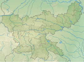
R Parasnath Hill and other locations in the Giridih district in North Chotanagpur Division. Key: M: municipality, C: census town, R: rural/ urban centre, H: historical/ religious/ tourist centre Click or prolonged tap on icons for detail. Owing to space constraints, the locations on click through to the larger map may vary slightly. Location of Parasnath peak in Jharkhand | |
| Location | Pirtand CD Block, Giridih, Jharkhand, India |
| Parent range | Parasnath Range |
| Climbing | |
| Easiest route | Pilgrimage Treking |
Parasnath is a mountain peak in the Parasnath hill range. It is located towards the eastern end of the Chota Nagpur Plateau in the Giridih district (Hazaribagh district in British India) of the Indian state of Jharkhand, India.[2] The hill is named after Parshvanatha, the 23rd Jain Tirthankara who got salvation here.[3] In this connection, there is Jain pilgrimage Shikharji on the top of hill. The hill is also known as Sammet Shikhar (lit. 'great mountain', the supreme deity) by other autochthonous of the region in religious context.[4][5][6]
- ^ Parasnath Hill
- ^ "Official website of the Giridih district". Retrieved 7 March 2012.
- ^ "Parasnath / Marang Buru | DISTRICT GIRIDIH, GOVERNMENT OF JHARKHAND | India".
- ^ Choudhury, Pranab Chandra Roy (1975). Bihar. Publications Division, Ministry of Information and Broadcasting, Government of India. p. 60.
- ^ Indian Antiquary. Popular Prakashan. 1893. p. 295.
- ^ Transactions. India Mining, Geological, and Metallurgical Institute of. 1937. p. 61.
