Main Line of Philadelphia
Main Line, Philadelphia Main Line | |
|---|---|
Collection of suburban communities | |
 Map of the historic Philadelphia Main Line, c. 1895 | |
 Location of Pennsylvania in the United States | |
| Coordinates: 40°01′08″N 75°18′47″W / 40.019°N 75.313°W | |
| Country | |
| State | |
| County | Primarily Montgomery and Chester counties; certain northern parts of Delaware County |
| Named for | The Pennsylvania Railroad's Main Line |
| Demonym | Main Liner |
| Time zone | UTC-5 (EST) |
| • Summer (DST) | UTC-4 (EDT) |
| Area codes | 215, 267, 445, 610, and 484 |

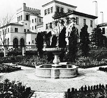
The Philadelphia Main Line, known simply as the Main Line, is an informally delineated historical and social region of suburban Philadelphia, Pennsylvania. Lying along the former Pennsylvania Railroad's once prestigious Main Line, it runs northwest from Center City Philadelphia parallel to Philadelphia and Lancaster Turnpike, also known as U.S. Route 30.
The railroad first connected the Main Line towns in the 19th century. They became home to sprawling country estates belonging to Philadelphia's wealthiest families, and over the decades became a bastion of "old money". The Main Line includes some of the wealthiest communities in the country, including Gladwyne,[2] Villanova, Radnor, Haverford, and Merion.[3][4] Today, the railroad is Amtrak's Keystone Corridor, along which SEPTA's Paoli/Thorndale Line operates.
- ^ "Population and Housing Unit Estimates". Retrieved June 9, 2017.
- ^ "Top-Earning Towns". Money.cnn.com. July 14, 2010. Retrieved July 23, 2012.
- ^ "America's Richest Zip Codes 2011". Archived from the original on January 7, 2012.
- ^ "15 Hottest Towns in Philadelphia's Western Suburbs". Main Line Today. February 14, 2019. Retrieved October 31, 2021.
