Back Qonce AF كينج ويليامز تاون ARZ Qonce Catalan King William's Town CEB King William's Town Danish Qonce German Qonce Spanish King William’s Town ET King William’s Town Finnish King William's Town French
This article needs additional citations for verification. (June 2020) |
Qonce
King William's Town | |
|---|---|
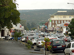
 Street scene | |
| Coordinates: 32°53′S 27°24′E / 32.883°S 27.400°E | |
| Country | |
| Province | Eastern Cape |
| District | Buffalo City |
| Municipality | Buffalo City |
| Established | 1835[1] |
| Area | |
• Total | 65.52 km2 (25.30 sq mi) |
| Elevation | 398 m (1,306 ft) |
| Population (2011)[2] | |
• Total | 34,019 |
| • Density | 520/km2 (1,300/sq mi) |
| Racial makeup (2011) | |
| • Black African | 65.3% |
| • Coloured | 25.6% |
| • Indian/Asian | 2.5% |
| • White | 5.6% |
| • Other | 0.9% |
| First languages (2011) | |
| • Xhosa | 54.5% |
| • Afrikaans | 27.3% |
| • English | 13.7% |
| • Other | 4.4% |
| Time zone | UTC+2 (SAST) |
| Postal code (street) | 5601 |
| PO box | 5600 |
| Area code | 043 |
Qonce, formerly King William's Town,[3] is a town in the Eastern Cape province of South Africa along the banks of the Buffalo River. The town is about 60 kilometres (37 mi) northwest of the Indian Ocean port of East London. It has a population of around 35,000 inhabitants and forms part of the Buffalo City Metropolitan Municipality.
The town lies 389 m (1,276 ft) above sea level at the foot of the Amathole Mountains in an area known for its agriculture. The town has one of the oldest post offices in the country developed by missionaries led by Charles Brownlee.[4]
- ^ Robson, Linda Gillian (2011). "Annexure A" (PDF). The Royal Engineers and settlement planning in the Cape Colony 1806–1872: Approach, methodology and impact (PhD thesis). University of Pretoria. pp. xlv–lii. hdl:2263/26503.
- ^ a b c d "Main Place King William's Town". Census 2011.
- ^ "Two SA airports – and Port Elizabeth – just got official new names". News24 Business Insider. 23 February 2001. Retrieved 24 February 2021.
- ^ "King William's Town – Steeped in History". www.privateproperty.co.za. Retrieved 24 August 2021.


