Reid Highway | |
|---|---|
 | |
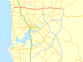
| Map of Perth's central suburbs with Reid Highway highlighted in red | |
 | |
| General information | |
| Type | Highway |
| Length | 23.6 km (15 mi) |
| Opened | 1980s |
| Route number(s) | |
| Major junctions | |
| West end | |
| |
| East end | |
| Location(s) | |
| Major suburbs | Balcatta, Mirrabooka, Malaga, Beechboro, Caversham |
| Highway system | |
| ---- | |

Reid Highway is a 23-kilometre (14 mi) east-west highway and partial freeway in the northern suburbs of Perth, Western Australia, linking North Beach with Middle Swan. As part of State Route 3, it forms half of Perth's outer ring road along with Roe Highway, which it joins onto at its eastern terminus.
The highway has many different speed limits and road conditions along its length, but is predominantly a four-lane dual carriageway with a 90 km/h (56 mph) speed limit. A 12-kilometre (7 mi) section, between Erindale Road and Altone Road (which makes up just over half the highway's length), is a continuous freeway. In conjunction with Tonkin Highway, it serves as an important arterial connection between Perth's coastal and eastern suburbs, industrial areas and Perth Airport.
